Introduction

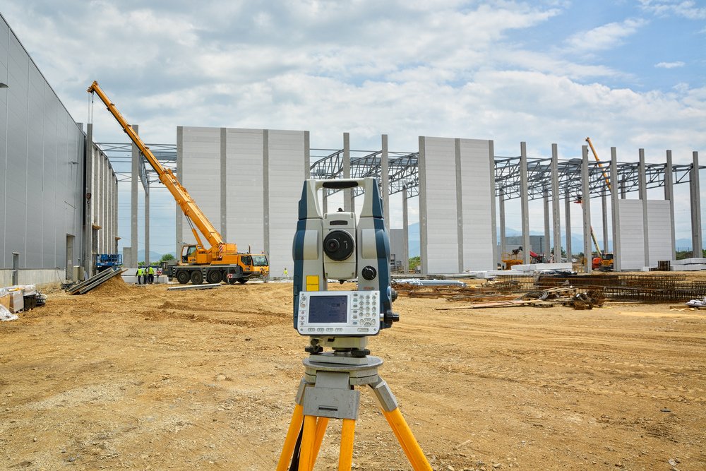
Excavation has long been a crucial part of construction, utility maintenance, and environmental projects. In Australia, where underground utilities are dense and urban expansion is ongoing, traditional digging methods often pose significant risks. From accidental damage to underground infrastructure to safety hazards for workers, conventional techniques are no longer meeting modern demands.

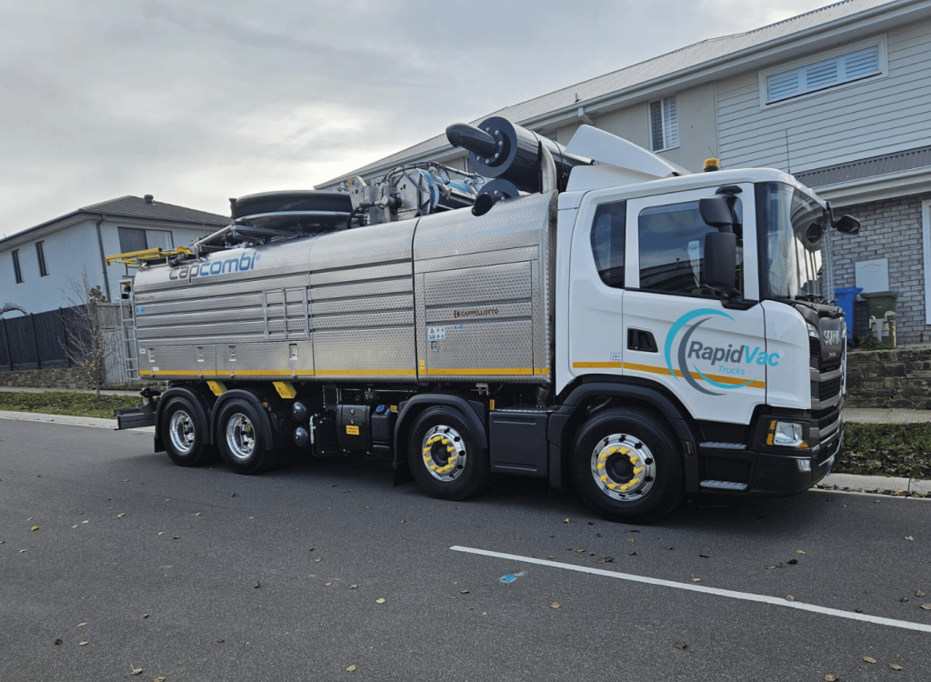
Enter vacuum excavation trucks – an innovative and safe alternative that is transforming the industry. These high-tech vehicles use advanced suction technology to excavate soil and debris without causing damage, offering unparalleled precision and safety. As industries across Australia seek smarter solutions, vacuum excavation trucks are emerging as the future of excavation.

What Are Vacuum Excavation Trucks?

Vacuum excavation trucks are specialised vehicles designed to perform non-destructive digging (NDD). Unlike traditional excavation methods that use heavy machinery or manual labour, these trucks rely on high-powered vacuum systems to safely remove soil. By combining air or water pressure with suction, they efficiently expose underground utilities, pipelines, and cables without the risk of damage.

The key components of a vacuum excavation truck include:

  • Vacuum System: A high-powered mechanism that suctions soil and debris.
  • Air or Water Lance: A tool that uses pressurised air or water to break up compacted soil.
  • Debris Tank: A storage compartment for collected materials.

This process not only ensures safety but also reduces the need for invasive digging, making it ideal for Australia’s urban landscapes and environmentally sensitive areas.

The Importance of Safety in Excavation

Excavation in Australia comes with inherent risks, particularly in areas with extensive underground networks such as Sydney, Melbourne, and Brisbane. Traditional digging methods often result in accidental strikes on gas lines, water pipes, or electrical cables, leading to costly repairs, project delays, and even serious injuries.

With increasing regulations around workplace safety and environmental preservation, the demand for safer excavation techniques has never been higher. Vacuum excavation trucks address these challenges by offering a controlled, non-destructive approach. This not only safeguards critical infrastructure but also protects workers, communities, and the environment.

By minimising risk and ensuring compliance with Australian safety standards, vacuum excavation is quickly becoming the preferred method for contractors and utility companies nationwide.

Benefits of Vacuum Excavation Trucks

Vacuum excavation trucks offer numerous advantages over traditional digging methods, particularly in Australia, where safety and environmental concerns are paramount. Here are some of the key benefits:

Safety and Precision

By using air or water to break apart soil and vacuum systems to remove it, vacuum excavation ensures precise digging. This significantly reduces the likelihood of striking underground utilities, making it one of the safest excavation methods available.

Non-Destructive Digging

Unlike mechanical excavation, which can damage infrastructure and disrupt surrounding areas, vacuum excavation is non-invasive. This makes it particularly useful in densely populated cities like Sydney and Melbourne, where underground utilities are intricate and extensive.

Efficiency

Vacuum excavation trucks are faster and more accurate than traditional methods, reducing project timelines. For contractors and utility companies, this means quicker service delivery and less disruption to the public.

Cost-Effectiveness

Accidental damage during traditional excavation often leads to expensive repairs and delays. By preventing these incidents, vacuum excavation minimises costs, making it a cost-effective choice for both small-scale and large-scale projects.

Applications of Vacuum Excavation Trucks

The versatility of vacuum excavation trucks makes them indispensable across various industries in Australia. Some of the most common applications include:

Utility Maintenance

Vacuum excavation is ideal for safely locating and exposing underground utilities such as gas lines, water pipes, and electrical cables. Utility companies across Australia rely on this method to prevent damage during routine maintenance and repairs.

Construction and Trenching

For construction projects requiring precise trenching or excavation in sensitive areas, vacuum excavation trucks provide a reliable solution. This is particularly useful for projects in urban areas where space is limited and infrastructure is dense.

Landscaping and Environmental Projects

In environmentally sensitive areas, vacuum excavation minimises disruption to the natural habitat. It is widely used in landscaping projects, as well as in the preservation of cultural heritage sites across Australia.

Emergency Excavation Work

In urgent situations such as water main breaks or gas leaks, vacuum excavation trucks enable quick and safe digging. This ensures minimal disruption to services and helps address the issue promptly.

How Vacuum Excavation Trucks Are Changing the Industry

The adoption of vacuum excavation trucks is transforming Australia’s excavation industry. As more contractors and utility companies shift towards non-destructive methods, the benefits are becoming increasingly apparent.

One of the most significant changes is the emphasis on safety. Vacuum excavation has set a new standard, helping companies comply with stringent workplace health and safety regulations. Moreover, its efficiency and precision are driving cost savings and improving project timelines, giving businesses a competitive edge.

Industries ranging from construction to utilities are recognising the value of this technology. With its ability to deliver consistent, high-quality results, vacuum excavation is becoming the go-to solution for modern excavation needs in Australia.

Environmental Benefits of Vacuum Excavation

In an era where environmental conservation is critical, vacuum excavation trucks provide a sustainable alternative to traditional digging methods. In Australia, where protecting natural habitats and reducing emissions are priorities, this technology aligns perfectly with national goals.

Minimised Environmental Disruption

Vacuum excavation trucks perform precise digging, significantly reducing the impact on the surrounding environment. This makes them ideal for projects in protected areas, such as wetlands and national parks, or urban areas with stringent environmental regulations.

Reduced Carbon Footprint

Traditional excavation often involves heavy machinery that emits significant levels of greenhouse gases. In contrast, vacuum excavation trucks use energy-efficient systems that reduce overall carbon emissions, making them a greener choice.

Preserving Sensitive Ecosystems

Australia’s rich biodiversity means excavation projects must be handled with care to avoid damaging delicate ecosystems. Vacuum excavation ensures minimal disturbance, preserving native flora and fauna while still achieving project goals.

Technological Advancements in Vacuum Excavation Trucks

The technology behind vacuum excavation trucks is continuously evolving, further solidifying their role as a leading solution for safe excavation in Australia. Recent advancements have focused on improving efficiency, precision, and ease of use.

Enhanced Suction Power

Modern vacuum excavation trucks feature improved suction systems capable of handling denser soils and debris. This advancement ensures faster excavation times, even in challenging conditions such as Australia’s varied terrains.

Filtration Systems

Innovative filtration technologies now allow vacuum excavation trucks to manage debris more effectively, reducing downtime and enhancing performance. This is particularly beneficial in urban projects where debris management is a critical concern.

Automation and Smart Technology

Many vacuum excavation trucks now incorporate smart technologies, including sensors and automated systems. These features enhance precision and provide real-time feedback, allowing operators to work more efficiently while maintaining safety standards.

The Future of Vacuum Excavation

As industries across Australia continue to embrace safer and more sustainable practices, the future of vacuum excavation looks promising. This technology is expected to play an increasingly significant role in addressing the challenges of modern excavation.

Trends Driving Growth

Key trends such as urbanisation, stricter safety regulations, and environmental concerns are driving the adoption of vacuum excavation trucks. These factors are likely to propel further innovation in the field, making the technology even more versatile and accessible.

Increased Adoption Across Industries

From utilities and construction to environmental projects, vacuum excavation is becoming the preferred choice for a wide range of applications. Its ability to deliver precise and non-destructive results is earning the trust of stakeholders nationwide.

Continued Technological Innovation

With ongoing advancements in technology, vacuum excavation trucks are set to become even more efficient and user-friendly. Features such as AI-driven systems and enhanced energy efficiency will likely define the next generation of these vehicles.

Conclusion

Vacuum excavation trucks are redefining the way excavation is performed across Australia. With their unparalleled safety, precision, and environmental benefits, they address many of the challenges associated with traditional digging methods. By minimising risks, reducing costs, and protecting the environment, companies like Rapid Vac Trucks have become the go-to solution for modern excavation projects.

As industries continue to evolve, the demand for vacuum excavation trucks will only grow. By adopting this innovative technology, Australian contractors and utility companies can ensure compliance with safety standards, enhance efficiency, and contribute to a more sustainable future. It is clear that vacuum excavation trucks are not just the present but the future of safe excavation.

FAQs

1. What is a vacuum excavation truck used for?

A vacuum excavation truck is used for non-destructive digging, safely exposing underground utilities, pipelines, and cables. It is also ideal for precise excavation in construction, utility maintenance, and environmental projects.

2. How does vacuum excavation differ from traditional digging methods?

Unlike traditional digging methods that use heavy machinery or manual labour, vacuum excavation relies on air or water pressure to loosen soil, which is then suctioned into a debris tank. This reduces the risk of damaging underground utilities and minimises environmental disruption.

3. Are vacuum excavation trucks cost-effective?

Yes, vacuum excavation trucks can save costs by preventing accidental damage to underground utilities, reducing project timelines, and lowering the environmental impact. They also minimise the need for post-excavation repairs and cleanup.

4. Where are vacuum excavation trucks commonly used in Australia?

Vacuum excavation trucks are widely used in urban centres such as Sydney, Melbourne, and Brisbane for utility maintenance, construction, and emergency repairs. They are also employed in environmentally sensitive areas for non-invasive excavation.

5. Is vacuum excavation suitable for all types of soil conditions?

Yes, vacuum excavation is versatile and can handle a variety of soil conditions, including compacted soil, clay, and loose sand. Advanced trucks are equipped with enhanced suction power to manage even the toughest terrains.

City Surveyors perform boundary, topographic and design level surveys to support public projects and right of way acquisition. Depending on the scope of work, may also provide construction staking services.

Adelaide is on the cusp of a multi-billion transformation by 2050 that will have a profound impact on the way we live, work and play. The city is on the cutting edge of innovation and a new generation of high tech enterprises are driving the future of our city.

Building the Future of Adelaide The Expertise of City Surveyors

Asset Management

Asset management is the systematic process of maintaining, upgrading, and operating physical assets cost-effectively. It’s a critical business strategy that unlocks efficiency and accountability.

Often overlooked, asset management can contribute to the growth of an organization and improve financial sustainability. It’s also a key part of managing risk and reducing the costs of maintaining or disposing of your company’s assets.

As an asset manager, you work with a wide variety of property types and investment opportunities. Some managers specialize in specific regions or markets, and others are experts at the fundamentals of real estate analysis.

As an asset manager, you may be involved with property acquisitions, drafting property agreements and leases, and marketing commercial properties. The primary goals of asset management are to maximize revenue and minimize expenses in order to maintain stable net operating income.

Building Surveying

As a Building Surveyor, you assess and advise on the design, construction and maintenance of buildings. Ensure they meet legislative requirements for safety, sustainability and preservation.

You work with clients, construction crews and local planning authorities to ensure buildings are structurally sound, energy efficient, accessible, and able to be occupied safely. You conduct onsite inspections during the construction process and advise on building defects.

A good surveyor will carefully examine every element of a building, recording its dimensions and condition. This ensures they have a complete understanding of the building and its components before advising on any changes or repairs.

Planning

Planning is a process that requires defining goals, objectives and devising a strategy to achieve them. It also includes ensuring that resources are allocated for success.

Surveyors in Adelaide are experts in mapping and collecting data that can help to build a smart city. They are able to use data collection software such as building information modeling (BIM) to synchronize a digital database of existing infrastructure, improvements and future expansion plans.

Moreover, City Surveyors are skilled at identifying and pinpointing underground utilities and structures to reduce risk for property owners. They can provide a digital Utility Atlas, which provides a comprehensive map of all underground utilities and structures.

Planning can be a very complex process and requires participation from all relevant stakeholders. This ensures that everyone understands and is committed to achieving the plan.

Inspections

Inspections are a great way to ensure that the property you’re buying is safe, secure and in good condition. A professional home inspector will go through all of the major systems in a house and make note of any issues that could cause problems down the road.

A standard inspection includes checking the heating system, central air conditioning, plumbing, electrical system, roof, attic and visible insulation, walls, ceilings, floors, windows and doors. Some inspectors will also look for termite damage, mold and asbestos.

Surveying is a very complex process and requires a lot of expertise. A surveyor needs to invest in a variety of different instruments that will help them carry out the work properly. These include ranging rods, pegs and optical squares.

City surveyors are working with Brisbane city council to help plan the future layout of the city. This includes accommodating growth, building sustainable developments, improving transport, encouraging employment and keeping green spaces large and connected.

Australian capital cities are undergoing rapid urban expansion in response to the “Great Australian Dream” of home ownership. This expansion often occurs on the fringe of a city, where land is relatively cheap and financial returns are high.

The Importance of City Surveyors in Brisbanes Urban Development

1. Utility Atlases

When planning new developments or repairing existing ones, it’s important to locate and map underground utilities like electric wiring, gas lines, water pipes, sewerage networks and telecommunications. These maps help project managers avoid costly utility relocations and can reduce construction delays, damages and liability costs.

In Brisbane, Council identifies and invests in infrastructure as part of its Local Government Infrastructure Plan (LGIP). The LGIP shows where urban development is expected to occur and what type of services may be required for each zone.

In addition to LGIP, city councils can also use their long-term infrastructure plans and Netserv Plans. These provide Council with a better understanding of what needs to be delivered in the future. Among other things, these plans can include ratios for infill versus greenfield development.

2. Set-Out Surveys

Surveyors in Brisbane are working with Brisbane City Council to help plan the future layout of the city, accommodating growth, building sustainable developments, improving transport and encouraging employment.

The process of city planning also helps to ensure that green spaces are kept large and connected. This can increase social cohesion, reduce crime and encourage community participation.

Set-out surveys are an important part of the construction process and should be conducted before any construction work begins. Inaccurate set-outs can cause major problems later on, resulting in costly delays.

Set-out surveys are essential for many different construction projects, including residential and commercial development, roads, bridges, railways and more. They provide the base data for civil design and allow the construction team to build the project exactly as it was planned.

3. Surveying for Subsidence

City surveyors are in a unique position to help with the town planning of Brisbane. By designing places that are convenient to live, work and play, they can increase social cohesion, reduce crime and encourage community participation.

Creating smart cities requires accurate data. This means collecting the right information about existing infrastructure, improvements and future expansion plans.

Subsidence monitoring is one way that land surveyors can do this. They use specialised equipment to take precise measurements of the ground under a structure.

This can help them determine whether a property is susceptible to subsidence and how the issue might be remedied. They may also need to carry out geographical surveys that can identify issues with soil instability and drainage. This can also prevent subsidence from happening in the future.

4. Geotechnical Surveys

City surveyors are essential in Brisbane’s urban development as they provide key data and mapping for a range of projects. These include data collection and management, zoning and land use, and infrastructure.

For example, geotechnical surveys help to determine the soil conditions of a property. This information is important for any construction project.

Whether you’re planning to build a new house, renovate an existing property, or subdivide a block, you will need a plan and a permit. Your town planner will review your plans and check that they are in line with the current town planning codes.

5. Topographic Surveys

When it comes to developing residential and commercial space, topographic surveys are an essential part of the process. They help to design new buildings, new roads and drainage runs.

A topographical survey, also known as a feature contour survey, details the land’s features in terms of height, depth and size. These may include hills, rivers, trees and fences.

Using modern equipment such as drone survey photogrammetry, the data that a topographic survey captures can be used to create an accurate three-dimensional model of the site.

A topographic survey can provide the information that you need to obtain a zoning permit or mortgage loan for construction work on your property. It can also reveal any environmental issues that you need to know about before a project goes ahead.

Whether you’re planning a new house or a major renovation, navigating the Gold Coast’s complex property market requires accurate surveying. This is an essential step in protecting property owners’ rights, and avoiding costly disputes.

City surveying is the process of determining boundaries, locating sanitary and water pipes and identifying electrical lines. It involves using ranging rods, pegs, optical squares, and arrows.

What to Look for in a Professional City Surveyor in Gold Coast

Accurate Land Surveys

Accurate land surveys are an essential part of any property development project. They ensure that a property is built within its legal limits and prevent costly disputes down the line.

During an accurate land survey, a land surveyor uses an array of digital measuring equipment to map the location of points on the ground. These points include corner marks, a road frontage, an adjoining property and so on.

Once the measurements are collected, they are processed and compared to existing data. This can involve research and checks on past records (original surveys, recent subdivisions, or adjoining property surveys) to confirm that all of the original survey measurement data is correct and accurate.

This information is then digitally plotted on a digital map to provide the client with the most accurate evidence available to determine property boundaries. This process also involves converting old units of measurement (such as chains, rods, links and Spanish varas) into modern equivalents such as feet and US survey feet.

Boundary Realignment

Boundary realignment is an important consideration when it comes to navigating the Gold Coast’s complex property market. It is a process that can lead to a number of issues and requires expert surveying advice.

The first thing to note is that any adjustment to a suburban boundary needs to be approved by the Office of the Surveyor General and this can take up to six months or longer.

It is also a good idea to seek independent legal advice when attempting to resolve any such issues. Under Clause 2.75 of the Codes SEPP, a ‘boundary realignment’ must not increase the area of any lot by more than 10% in a residential zone.

This means that any change to a suburb boundary can be costly to undertake and may be problematic for some residents. As such, Council has undertaken preliminary consultation and will continue to seek community input on the issue. In the event that a majority of the ratepayers support the option to realign boundaries, Council will proceed with the proposal.

Topographic Surveys

Topographic surveys are a critical component of any property development project. They reveal all natural and man-made features on a site, including hills, rivers, trees, fences, buildings and other improvements.

While these surveys are often required by local government bodies, they can be used by engineers and architects for a myriad of practical applications. They also help to reduce the chance of terrain-related errors during construction.

A topographic survey map depicts the location, size and height of all land features and any gradual changes or contours in elevation. It also shows where roads, utilities and other infrastructure are located.

Historically, these maps were drawn manually and plotted on physical mediums such as paper. However, these days, they are often provided in digital form as a CAD drawing.

Cadastral Surveys

Cadastral surveys are a critical part of Land Surveyor in Gold Coast. They determine the physical location of property boundaries for legal purposes and before property taxes.

They also provide important information about how a piece of land is divided between different owners and parties. They can also be used to establish ownership of subsoil, water rights, and other features that are associated with a property.

The government entrusts licensed cadastral surveyors to maintain and protect the integrity of the cadastre. This helps people to have confidence in their lands and properties.

In addition, cadastral surveys help governments and land information agencies manage their cadastre data. This involves using GIS technology and cadastral survey software solutions.

The Gold Coast has experienced significant growth in property prices in the past year, driven by strong demand and tight supply. However, rising construction costs and tighter lending conditions could limit the region’s future growth. Despite these challenges, the region’s strong population growth and booming economy will likely continue to drive demand.

Accurate surveys are important for a wide range of purposes, including determining property boundaries and supporting construction projects. They also help project managers and owners get a clear picture of a site’s conditions before it’s built.

Fortunately, Sydney surveyors have the expertise and experience to deliver accurate surveys on time and within budget. Whether you need a boundary survey, contour survey, engineering survey or aerial survey, we’re here to help.

Boundary Surveys

Accurate surveys are an important part of property ownership. Whether you want to build a fence, add a sunroom or pave your driveway, a boundary survey makes sure that the construction is done correctly on your property and that it doesn’t encroach on your neighbors property or violate building codes.

A boundary survey typically consists of a combination of field work and research. The research phase involves a series of steps to determine and locate the boundaries of a parcel of land.

First, the surveyor does extensive registry research in the county recorder of deeds. This involves locating and reviewing the deeds for each parcel.

After that, the fieldwork begins and the surveyor explores the property and marks each corner.

After the fieldwork is completed, a surveyor will begin to construct a map or plat of the property showing all the boundary lines and monuments that are located on the property. This is the most visible portion of a boundary survey and usually accounts for about a third of the total survey.

Contour Surveys

If you’re building a home or other structure, a contour survey is essential. This helps determine the layout of your land and whether there are any retaining walls required.

Contour surveys are often performed alongside soil tests. This allows for a more accurate estimate of how much soil you’ll need to remove and how much it may impact the build.

The accuracy of contour surveys depends on the type of topography that your land has. Closely spaced contour lines describe steep slopes, while widely spaced lines indicate gentle terrain.

When it comes to estimating the accuracy of your survey, it’s crucial to hire a reliable and experienced contour surveyor. Land surveyor in Sydney provides professional survey services in Australia.

Engineering Surveys

Engineers and architects use surveying data to help them with planning, design and construction of their buildings. It can include topographic surveys, 3D laser scanning surveys and more.

During the design, planning, and pre-construction phases of a project, surveyors are responsible for taking precise measurements, updating boundary lines, and preparing space or land for construction. They also provide important information to project managers and owners that will help them determine whether a site is usable for the intended purpose.

In the United States, the American Society of Civil Engineers (ASCE) defines engineering surveying as activities involved in the planning and execution of surveys for the planning, design, construction, operation, and maintenance of engineered projects. ASCE believes that the provision included in NCEES Model Law that “surveying incidental to the practice of engineering” is equivalent to this definition of surveying.

Aerial Surveys

Aerial surveys are an increasingly popular form of surveying that allows surveyors to cover a large area and get high-resolution images. The photos can be used to create a range of products, including topographical maps, aerial photographs and more.

A surveyor will first identify the area of interest and set up a temporary site where they can take the aerial photos. They will also need to be careful not to interfere with any buildings or people on the property during the survey.

Aerial surveys are a fast and efficient way to capture high-quality imagery. They can be completed in one single flight and are ideal for larger sites or areas that are hard to reach.

If you’re planning to undertake a construction project, it’s important to hire surveyors in Wollongong before you start. They can help you avoid costly pitfalls and get the job done right.

Land surveyors are experts in determining the boundary lines and above-ground utilities on a property. This helps ensure that you don’t build anything outside of your property boundaries.

Road Design

Road design is a crucial aspect of any construction project, and it requires the skills of a Wollongong surveyor. They are responsible for ensuring that the roadway is constructed in a manner that meets all legal requirements and safety standards, while also optimizing the costs of the construction project.

A good road design includes elements such as the number and width of lanes, alignment, cross slopes, designed cross sections, excavation and embankment volumes, drainage structures, turnouts, and surfacing requirements. The design also considers the equipment anticipated for use during construction and how this will affect material movement distances and balance points.

Road geometry also impacts the sight distance available to a vehicle driver, and the road engineer works to ensure that the line of sight is clear before a hill crest or object blocks it. This is important for the safety of motorists and other road users.

Boundary Lines

When you are building a new home, it is essential to have the property boundaries surveyed before you start work. This will help you prevent encroachment on your neighbor’s land.

Similarly, for construction projects that are in strict city zoning, it is important to have a survey conducted to ensure that all land boundaries are clearly defined before the project begins. A quality Wollongong surveyor will be able to carry out these services for your benefit, saving you time and money.

Many neighbors resolve their boundary questions by simply agreeing on a line that makes sense to both of them. When this agreement is made and certain conditions are met, it becomes the permanent legal boundary between the two properties. It is binding not only on those neighbors, but on later buyers as well.

Visible Utilities

If you’re planning a construction project in Wollongong, hiring a reliable team of surveyors can help ensure your construction project runs smoothly. They can also save you time and money by preventing any unnecessary expenses.

Quality Level C, the most commonly used quality level, is based on surveying visible above-ground utility facilities and correlating them to existing utility records (QL-D information). This method is often the most effective for rural projects because most underground utilities are either omitted or incorrectly plotted.

Quality Level A, which GPRS provides with every utility locating job, involves physically locating the actual utility – often by “potholing” it or daylighting it – and subsequently locating it horizontally and vertically by survey measurements. This data can be utilized on any job and is especially helpful for verifying concrete encased duct banks.

Easements

An easement is a right of access held by someone else to use a certain piece of land. It is used to run services like power, water and telecommunications or put in roads.

A common example of an easement is a drainage easement, where drainage pipes will pass through multiple properties to enable water and sewerage to be drained. This helps to benefit the whole neighbourhood and can be useful for building development.

Another type of easement is an Easement of Way, also known as a carriageway, whereby one owner grants access to another for a defined strip of land. This can appear as an encumbrance to the property owner that the easement passes through but is a benefit to the person who owns the plot to which it provides access.

A surveyor can help you identify easements on your property. They can help you determine whether or not they are legal and how they will impact your construction project.

Surveyors in Canberra use a variety of techniques to determine the true shape of land. They provide data for civil engineers who plan infrastructure, including roads, bridges and buildings.

These professionals are essential for projects that require a planning permit. They also help with zoning and overlays, such as those that protect vegetation, heritage or wildlife.

The National Capital Authority (NCA)

The National Capital Authority (NCA) performs a range of functions in respect of protecting the Commonwealth’s interest in planning and managing Canberra as Australia’s capital.

It prepares and administers a National Capital Plan that serves the interests of the Australian Government, the nation and its people. It shapes the future of the capital; manages and enhances the nationally significant parts of Canberra; and fosters awareness of Canberra as Australia’s national capital.

For the first 75 years of Canberra’s development, the design plan was based on the vision of the Americans Walter Burley Griffin and Marion Mahony Griffin that placed it as a ‘city in the landscape’ nestled amongst forested hills and astride the impounded waterway of the Molonglo River. The two land and water axes were aligned with four local mountain summits and crossed the city to link nationally significant building sites in conspicuous positions against the forested landscape as a backdrop.

Since self-government in 1988, planning has been governed increasingly by the global orthodox canon of increasing urban densification and high-rise buildings without regard for the significance of the context and setting of Canberra. The result is low priority of heritage considerations leading to loss of heritage precincts and downplaying of the historic landscape ethos that encapsulates Canberra’s unique character and symbolic meaning.

Traversing

Canberra is known for its expansive parklands, lakes and urban forests. Treed spaces are a key feature of the city’s design and provide many benefits including cooling, shade and landscape amenity.

But the trees’ unique character is threatened by the accelerating pace of urban development and climatic change. As a result, the canopy cover in Canberra’s older suburbs is declining and new suburban areas are growing without extensive tree coverage.

In this paper, we explore the role of traversing in shaping Canberra’s urban landscape and how it can contribute to re-wilding and climate responsive urban planning and governance practices for cities as coupled human-natural systems.

In this study, we conducted interviews with experts from a range of disciplines that work with or have an interest in green spaces in Canberra. These experts reflected on the value of Canberra’s green spaces and discussed the Ecosystem Services (ESS) they provide.

Offsetting

Architects, engineers and planners depend on surveying data to design and construct buildings. They use topographic and 3D laser scanning surveys to understand the land.

They also use Geographic Information Systems (GIS) to present spatial information visually as maps, reports and charts. They overlay aerial and satellite images with GIS data to plan roads, utilities, and landscaping projects.

When planning a large infrastructure project, they need to be aware of the environment and how it affects construction. These measurements help them make informed decisions and ensure that the construction process goes smoothly.

Offsetting is a form of accounting that nullifies financial entries with equal but opposite entries to cancel out the original entry. It is a key principle of accounting and a powerful tool to limit or eliminate liabilities.

Surveyors

Surveyors use the latest technology to take measurements of land, and provide data that architects, engineers and planners need for planning and building. The data is then used to plan roads, bridges and utilities.

Surveyors make precise measurements to determine property boundaries, which can help prevent and resolve disputes. They also use their measuring equipment to create maps and reports that show changes in property lines.

They work outdoors and often cover long distances when conducting their surveys. This can be physically demanding, so employers often look for candidates with excellent physical stamina and problem-solving skills.

The job is generally full-time with a government or private organisation. During the course of a project, surveyors may travel across different parts of the country and stay away from home for an extended period.

Uncovering the Mysteries of Land Legal Descriptions

[ad_1]

Uncovering the Mysteries of Land Legal Descriptions

Whether you’re buying or selling a piece of property, knowing the legal description of the land is essential. The legal description describes the exact boundaries of the parcel of real estate and is used for title searches, deed transfers, surveys, zoning, and more. Despite the importance of the legal description, many people find it confusing and difficult to understand. In this article, we’ll try to uncover some of the mysteries of land legal descriptions so you can better understand this important document.

What is a Legal Description of Land?

A legal description of land is a technical description of the boundaries of a particular parcel of real estate. It includes information about the location of the land, its size, and other details. Most legal descriptions of land are written using a format called metes and bounds. This format includes information about the size of the property, as well as directional and distance information that helps to identify the boundaries of the land.

What is Metes and Bounds?

Metes and bounds is a system of land surveying used to describe the boundaries of a parcel of land. It is based on the use of a compass and a measuring chain or tape. The measuring chain is used to measure distances along the boundary of the land from one point to another. The compass is used to determine the direction of the boundary lines.

Components of a Legal Description

A legal description of land typically includes the following components:

  • The starting point of the legal description
  • The direction and distances of the boundaries of the land
  • The land area and the shape of the parcel
  • The description of any objects or features that are included in the boundaries of the land

Examples of Legal Descriptions

A legal description of land can look something like this:

“Beginning at a point in the center of the north line of said section, thence running north 89 degrees 45 minutes east, 440 feet; thence south 00 degrees 15 minutes east, 880 feet; thence south 89 degrees 45 minutes west, 440 feet; thence north 00 degrees 15 minutes west, 880 feet to the place of beginning, containing 3.2 acres, more or less.”

Another example of a legal description of land might look like this:

“Commencing at a point in the center of the north line of said section, thence running north 89 degrees 45 minutes east, along the center line of said section, 440 feet; thence south 00 degrees 15 minutes east, 880 feet; thence south 89 degrees 45 minutes west, 440 feet; thence north 00 degrees 15 minutes west, 880 feet to the place of beginning, containing 3.2 acres, more or less.”

Conclusion

Understanding the legal description of land is essential for anyone involved in the buying or selling of property. Knowing how to interpret the legal description of land can help you to better understand the boundaries of the property and make sure you’re making a wise investment. With a little bit of knowledge and practice, you can master the mysteries of land legal descriptions.
[ad_2]

Utilizing Elevation Data to Accurately Represent Topography

[ad_1]

Utilizing Elevation Data to Accurately Represent Topography

Elevation data is a key component of understanding and accurately representing topography. Elevation data is used to create detailed topographical maps, analyze landforms, assess flood risk, and plan construction projects. This data is often gathered through the use of Global Positioning System (GPS) receivers and satellites. In order to create a detailed topographical map, elevation data must be collected from multiple sources and combined into a single, cohesive dataset.

GPS and Remote Sensing

GPS receivers are used to collect elevation data from the ground. The receivers measure the distance between the receiver and a satellite. By measuring the distance from several satellites, the receiver can determine its exact position and altitude. Remote sensing is another method used to collect elevation data. This method uses sensors on satellites to measure the Earth’s surface. The data collected is used to create detailed topographical maps.

Creating Topographical Maps

Once elevation data has been collected, it can be used to create detailed topographic maps. These maps are used to understand the shape of landforms and to plan construction projects. Topographic maps are created by superimposing a two-dimensional grid over the elevation data. The grid is then broken up into squares and each square represents an elevation. By creating this grid, it is possible to accurately represent the shape of the land.

Analyzing Slope and Flood Risk

Elevation data is also used to analyze slope and to assess flood risk. By measuring the difference in elevation between two points, it is possible to calculate the slope of the land. This information is important when assessing the potential for landslides and other hazards. It is also used to determine potential flood zones. By analyzing the elevation data, it is possible to identify areas that are at risk of flooding and make informed decisions about where to build and how to protect against flooding.

Conclusion

Elevation data is an essential tool for accurately representing topography. By collecting data from multiple sources and combining it into a single dataset, it is possible to create detailed topographical maps. This data can also be used to analyze slope and assess flood risk. Elevation data is an invaluable tool for understanding the shape of landforms and for planning construction projects.
[ad_2]

How to Use Control Points to Identify and Address Weaknesses in Your System

[ad_1]

How to Use Control Points to Identify and Address Weaknesses in Your System

Control points are an essential tool to help identify and address weaknesses in any system. They provide a way to measure and monitor the performance of the system, and to detect any problems that could lead to system failure. Control points can be used to assess the effectiveness of the system as well as the accuracy of the data produced. In this article, we will explain how to use control points to identify and address weaknesses in your system.

What is a Control Point?

A control point is a designated point in a system that is used to measure the performance of the system. It is typically monitored on a regular basis and used to detect any potential weaknesses or problems. Control points can be used to measure the accuracy of the data produced, as well as the overall performance of the system.

How to Identify Weaknesses in Your System

When using control points to identify weaknesses in your system, it is important to consider the following factors:

• Quality of the data: The quality of the data produced by the system should be monitored regularly to ensure accuracy and reliability. If the data is inaccurate or unreliable, it may lead to incorrect decisions or results.

• Efficiency of the system: The efficiency of the system should be monitored to ensure that it is operating at its optimal level. If the system is not performing as expected, it may be a sign of a weakness or problem.

• Security of the system: The security of the system should be monitored to ensure that it is not vulnerable to attack or exploitation. If the system is vulnerable, it may lead to data loss or other serious problems.

How to Address Weaknesses in Your System

Once any weaknesses in your system have been identified, it is important to address them as soon as possible. Here are some tips on how to address weaknesses in your system:

• Develop a plan: Develop a plan to address the identified weaknesses. This plan should include steps to improve the quality of the data, improve the efficiency of the system, and strengthen the security of the system.

• Monitor the system: Monitor the system on a regular basis to ensure that the plan is working and the weaknesses are being addressed.

• Update the system: Update the system regularly to ensure that it is operating at its optimal level.

• Test the system: Test the system regularly to ensure that it is producing accurate and reliable data.

Conclusion

Control points are an important tool for identifying and addressing weaknesses in any system. They provide a way to measure and monitor the performance of the system, and to detect any potential problems or weaknesses. By monitoring the system on a regular basis and developing a plan to address any issues, you can ensure that your system is operating at its optimal level and producing accurate and reliable data.
[ad_2]

Exploring the Benefits of Geodetic Devices for Surveying Projects

[ad_1]

Exploring the Benefits of Geodetic Devices for Surveying Projects

Surveying projects have been around for centuries, but the tools and techniques that are used today are much more advanced than in the past. One of the most important tools used in surveying projects is the geodetic device. Geodetic devices are used to measure distances and angles between two or more points on the surface of the Earth. Geodetic devices are used for a variety of purposes, including mapping, constructing, and engineering projects.

Geodetic devices are typically used in combination with other surveying equipment, such as total stations, theodolites, and GPS receivers. In addition to these instruments, geodetic devices are also used to measure the curvature of the Earth, the shape of the terrain, and the orientation of the surface. Geodetic devices are incredibly accurate and precise, making them an invaluable tool for any surveying project.

Types of Geodetic Devices

There are several different types of geodetic devices, each of which has its own unique advantages. The most common type of geodetic device is the Global Positioning System (GPS) receiver. GPS receivers use satellite signals to determine the exact location of any point on the Earth’s surface. They are incredibly accurate, and can be used to measure distances and angles between two or more points.

Another type of geodetic device is the theodolite. Theodolites are used to measure horizontal and vertical angles between two or more points. They are commonly used for surveying projects, such as mapping and engineering.

Finally, there are total stations, which are used to measure distances and angles between two or more points. Total stations are incredibly precise and accurate, and can be used to measure distances and angles with great accuracy.

Benefits of Geodetic Devices

The most obvious benefit of using geodetic devices for surveying projects is the improved accuracy and precision that they provide. Geodetic devices are incredibly accurate, and they can measure distances and angles with incredible precision. This can be incredibly useful for any surveying project, as it ensures that measurements are as accurate as possible.

Another benefit of geodetic devices is that they are relatively easy to use. GPS receivers, theodolites, and total stations can all be used by relatively inexperienced surveyors. This makes it easier for those who are new to surveying to get the job done quickly and efficiently.

Finally, geodetic devices are incredibly durable and reliable. They are built to withstand the harsh conditions that are often encountered during surveying projects, and they rarely require maintenance or repair. This makes them ideal for any surveying project, as they can be used over and over again without any problems.

Conclusion

Geodetic devices are an invaluable tool for any surveying project. They are incredibly accurate and precise, making them ideal for measuring distances and angles between two or more points. Geodetic devices are also relatively easy to use, and they are incredibly durable and reliable. These benefits make them an ideal tool for any surveying project.
[ad_2]

The Benefits of Utilizing Topographic Surveys

[ad_1]

What Is a Topographic Survey?

A topographic survey is an incredibly useful tool that allows professionals to collect data about the surface of the Earth. The survey is conducted by taking measurements of various features of the land, including contours, elevations, boundaries, and slopes. The data collected can then be used to create a topographical map, which shows an accurate representation of the land’s features.

What Are the Benefits of Utilizing Topographic Surveys?

Topographic surveys provide a variety of benefits to the user. Here are some of the most significant benefits of utilizing topographic surveys:

1. Accurate Information

One of the main advantages of topographic surveys is that they provide highly accurate information about the land. The measurements taken from the survey are precise and can be used to create detailed maps that show features such as contours, elevations, boundaries, and slopes. This level of detail is not possible with other types of surveys.

2. Cost-Effective

Topographic surveys are also cost-effective. They require minimal equipment and personnel, making them an affordable option for surveying a large area of land. Additionally, the data collected can be used multiple times, which helps to reduce costs in the long run.

3. Time-Saving

Topographic surveys are also time-saving. The data collected is available almost immediately, which means that decisions can be made quickly and accurately. Furthermore, the data can be used to create detailed maps of the land, which can be used for planning purposes or other activities.

4. Versatility

The data collected from a topographic survey can be used for a variety of purposes. It can be used to create detailed maps for planning, engineering, or construction projects. It can also be used to assess geological features in order to determine the best site for a new development.

5. Safety

Topographic surveys are also beneficial for safety purposes. The data collected can be used to identify potential hazards, such as cliffs, steep slopes, and hazardous terrain, which can then be avoided. This helps to ensure that workers and the general public remain safe.

Conclusion

Overall, topographic surveys are an invaluable tool that can provide a variety of benefits. They are accurate, cost-effective, time-saving, versatile, and beneficial for safety purposes. As such, they should be considered for any project that requires a detailed understanding of the land.
[ad_2]

How to Conduct a Subdivision Survey – Step by Step

[ad_1]

How to Conduct a Subdivision Survey – Step by Step

A subdivision survey is a process that is used to divide a property into smaller parcels of land. It is a detailed survey that is conducted by a licensed surveyor to ensure that the property is correctly divided and that all the boundaries are accurately defined. The process of conducting a subdivision survey can be complex and time-consuming, but it is important to ensure that all the legal requirements are met and that the subdivision is done properly. This article will provide a step-by-step guide on how to conduct a subdivision survey.

Step 1: Prepare the Documents

The first step in conducting a subdivision survey is to prepare the necessary documents. This includes obtaining a copy of the deed, a subdivision plat, and any other relevant documents. The deed is a legal document that outlines the legal boundaries of the property, while the subdivision plat is a map that shows the boundaries of the proposed subdivision. The documents should also include any restrictions or requirements that must be followed in order to divide the property.

Step 2: Determine the Boundaries

The next step in conducting a subdivision survey is to determine the boundaries of the proposed subdivision. This is done by measuring the boundaries of the property and then drawing a plat that shows the boundaries of the proposed subdivision. The plat should include not only the boundaries of the proposed subdivision but also any easements, rights-of-way, or other restrictions that may be applicable.

Step 3: Collect Field Data

Once the boundaries of the proposed subdivision have been determined, the surveyor must then collect field data. This data includes measurements and observations from the site, such as the position of existing boundaries, trees, vegetation, and other features. This data is used to create a detailed map of the property that includes the proposed subdivision.

Step 4: Prepare the Plat

The surveyor then uses the field data to create a detailed plat of the proposed subdivision. This plat includes measurements of the boundaries, as well as any easements, rights-of-way, or other restrictions that may be applicable. The plat should also include any other relevant information, such as the name of the subdivision, the size and shape of each lot, and the location of any utilities or other infrastructure.

Step 5: Obtain Approval

Once the plat has been prepared, the surveyor must then obtain approval from the local government or other relevant authority. This approval is typically needed in order for the subdivision to be legally recognized. The surveyor should be familiar with the relevant regulations and should be able to provide the necessary documentation in order to obtain the approval.

Step 6: Record the Plat

Once the plat has been approved, the surveyor must then record the plat with the county and/or state. This process ensures that the legal boundaries of the subdivision are officially recognized. The surveyor should be familiar with the relevant regulations and should be able to provide the necessary documentation in order to record the plat.

Conclusion

Conducting a subdivision survey is a complex process that requires knowledge and expertise. It is important to ensure that all the necessary steps are taken in order to divide the property accurately and legally. By following the steps outlined in this article, surveyors can ensure that the subdivision survey is conducted properly and that all the relevant legal requirements are met.
[ad_2]

Understanding the Process of a Boundary Survey

[ad_1]

Understanding the Process of a Boundary Survey

A boundary survey is a mapping and measurement of the boundaries of a parcel of land. It is one of the most important steps in the real estate process. It can help to ensure that the ownership of a property is accurately established and that the boundaries of the property are clearly defined. Understanding the process of a boundary survey can help to ensure that you are accurately documenting the boundaries of your property.

What is a Boundary Survey?

A boundary survey is a process which documents the legal boundaries of a parcel of land and is typically used to determine the exact location of a property line. It can also be used to establish the location of utilities, fences, and other structures on the property. The survey is conducted by a qualified surveyor and typically involves the use of a GPS-based mapping system. The surveyor will collect data from the field and then use that data to generate a map of the property boundaries.

Why is a Boundary Survey Important?

A boundary survey is an important step in the real estate process. It helps to ensure that the ownership of a property is accurately established and that the boundaries of the property are clearly defined. This information is essential for preventing boundary disputes between landowners and can help to avoid costly legal proceedings.

How is a Boundary Survey Conducted?

The process of a boundary survey typically begins with the surveyor visiting the property and gathering data from the field. This data is then used to generate a map of the property boundaries. The surveyor will also typically measure the distances between the boundaries and the structures on the property.

Once the data has been collected, the surveyor will create a report which outlines the boundaries of the property and includes a map of the property boundaries. This report is then submitted to the local government for approval. Once the report is approved, the surveyor will create a deed or plat which outlines the legal boundaries of the property.

Conclusion

Understanding the process of a boundary survey is an essential part of the real estate process. It is important to ensure that the boundaries of the property are accurately documented and that the ownership of the property is established. A boundary survey can help to prevent boundary disputes and can ensure that the property boundaries are clearly defined. By understanding the process of a boundary survey, you can ensure that you are accurately documenting the boundaries of your property.
[ad_2]

The Impact of Urban Planning on Sustainable Development

[ad_1]

The Impact of Urban Planning on Sustainable Development

Urban planning is a multidisciplinary practice with the goal of improving the quality of life in urban areas through the design and implementation of physical, social, economic, and environmental policies. Urban planning seeks to create an environment that is safe, healthy, and equitable for all residents while also promoting economic growth and sustainability. Urban planners must consider the long-term effects of their decisions and how they will impact the environment, public health, and the economic well-being of the community.

Urban planning is an essential component of sustainable development, as it enables cities to plan for and manage the impacts of population growth and urban development. Through careful planning, cities can ensure that growth is managed in ways that do not cause long-term harm to the environment, public health, or local economies. Urban planning can also help cities become more resilient in the face of climate change, as it can identify areas that are vulnerable to extreme weather events or sea level rise and create plans to reduce the risk of damage from these events.

Urban planning is also essential for creating equitable cities, as it ensures that development is distributed equitably and that all residents are able to access necessary services. By engaging with stakeholders from all sectors, urban planners can ensure that development meets the needs of the community and that all residents have access to quality housing, public transportation, and other basic services.

The Benefits of Urban Planning for Sustainable Development

Urban planning plays an integral role in promoting sustainable development, as it enables cities to plan for and manage the impacts of population growth and urban development in ways that are beneficial for both the environment and local communities. By carefully considering the social, economic, and environmental effects of their decisions, urban planners can ensure that growth is managed responsibly and that all residents have access to the resources they need to thrive.

Urban planning enables cities to create more efficient and sustainable transportation systems, as it can identify the most effective ways to reduce emissions and congestion. Urban planners can also create plans to make public transportation more accessible, as well as to promote walking and cycling as more viable transportation options.

Urban planning can also help cities adapt to climate change, as it can identify areas that are vulnerable to extreme weather events or sea level rise and create plans to reduce the risk of damage from these events. Urban planners can also create green infrastructure plans to reduce pollution, conserve energy, and reduce waste.

Conclusion

Urban planning is an essential component of sustainable development, as it enables cities to plan for and manage the impacts of population growth and urban development in ways that are beneficial for both the environment and local communities. By carefully considering the social, economic, and environmental effects of their decisions, urban planners can ensure that growth is managed responsibly and that all residents have access to the resources they need to thrive. Urban planning can also help cities become more resilient in the face of climate change, as well as to create more efficient and sustainable transportation systems and green infrastructure plans.
[ad_2]

Understanding the Subdivision Process For Land Owners

[ad_1]

Understanding the Subdivision Process for Land Owners

Subdividing land is a complex process that requires a lot of knowledge and experience. For land owners, it can be a confusing and overwhelming process to navigate. It is important to have a clear understanding of the requirements and regulations that will be involved when subdividing land. This article will provide an overview of the subdivision process for land owners, so that they can make informed decisions about their property.

Steps of the Subdivision Process

The first step in the subdivision process is to determine the zoning of the property. This will determine the types of development that can take place on the land. Depending on the zoning, it may be necessary to obtain a special use permit or variance from the local government.

Once the zoning has been determined, the land owner will need to submit a development application to the local government. This application will outline the proposed development and include any necessary supporting documentation. The local government will then review the application and determine whether or not the proposed development is in compliance with zoning regulations.

Once the local government has approved the development application, the land owner will need to begin the process of surveying the land. This process will involve mapping out the boundaries of the property and any proposed developments.

Once the surveying is complete, the land owner can begin the process of dividing the land. This will involve creating a plat, which is a map of the land and any proposed developments. The plat must be approved by the local government before any development can begin.

Costs Associated with Subdivision

The costs associated with the subdivision process can vary significantly depending on the size and complexity of the proposed development. Generally speaking, the costs will include surveying fees, legal fees, and fees for any necessary permits or variances.

In addition to the costs associated with the subdivision process, land owners should be aware of the potential tax implications. Depending on the type of development, it may be necessary to pay property taxes or other fees.

Benefits of Subdividing Land

One of the main benefits of subdividing land is the potential increase in property value. By dividing a larger parcel of land into smaller parcels, the value of the land can increase significantly. This can be a great way to maximize the potential value of a property.

In addition to increasing the value of the property, subdividing land can also provide a number of other benefits. By subdividing land, land owners can develop the land to meet their specific needs. This can include building residential homes, commercial buildings, or other structures.

Conclusion

Subdividing land can be a complex and time-consuming process, but it can also provide a number of benefits for land owners. It is important to have a clear understanding of the process and the associated costs before beginning the process. By having a clear understanding of the process, land owners can make informed decisions about their property.
[ad_2]