Accurate surveys are important for a wide range of purposes, including determining property boundaries and supporting construction projects. They also help project managers and owners get a clear picture of a site’s conditions before it’s built.

Fortunately, Sydney surveyors have the expertise and experience to deliver accurate surveys on time and within budget. Whether you need a boundary survey, contour survey, engineering survey or aerial survey, we’re here to help.

Boundary Surveys

Accurate surveys are an important part of property ownership. Whether you want to build a fence, add a sunroom or pave your driveway, a boundary survey makes sure that the construction is done correctly on your property and that it doesn’t encroach on your neighbors property or violate building codes.

A boundary survey typically consists of a combination of field work and research. The research phase involves a series of steps to determine and locate the boundaries of a parcel of land.

First, the surveyor does extensive registry research in the county recorder of deeds. This involves locating and reviewing the deeds for each parcel.

After that, the fieldwork begins and the surveyor explores the property and marks each corner.

After the fieldwork is completed, a surveyor will begin to construct a map or plat of the property showing all the boundary lines and monuments that are located on the property. This is the most visible portion of a boundary survey and usually accounts for about a third of the total survey.

Contour Surveys

If you’re building a home or other structure, a contour survey is essential. This helps determine the layout of your land and whether there are any retaining walls required.

Contour surveys are often performed alongside soil tests. This allows for a more accurate estimate of how much soil you’ll need to remove and how much it may impact the build.

The accuracy of contour surveys depends on the type of topography that your land has. Closely spaced contour lines describe steep slopes, while widely spaced lines indicate gentle terrain.

When it comes to estimating the accuracy of your survey, it’s crucial to hire a reliable and experienced contour surveyor. Land surveyor in Sydney provides professional survey services in Australia.
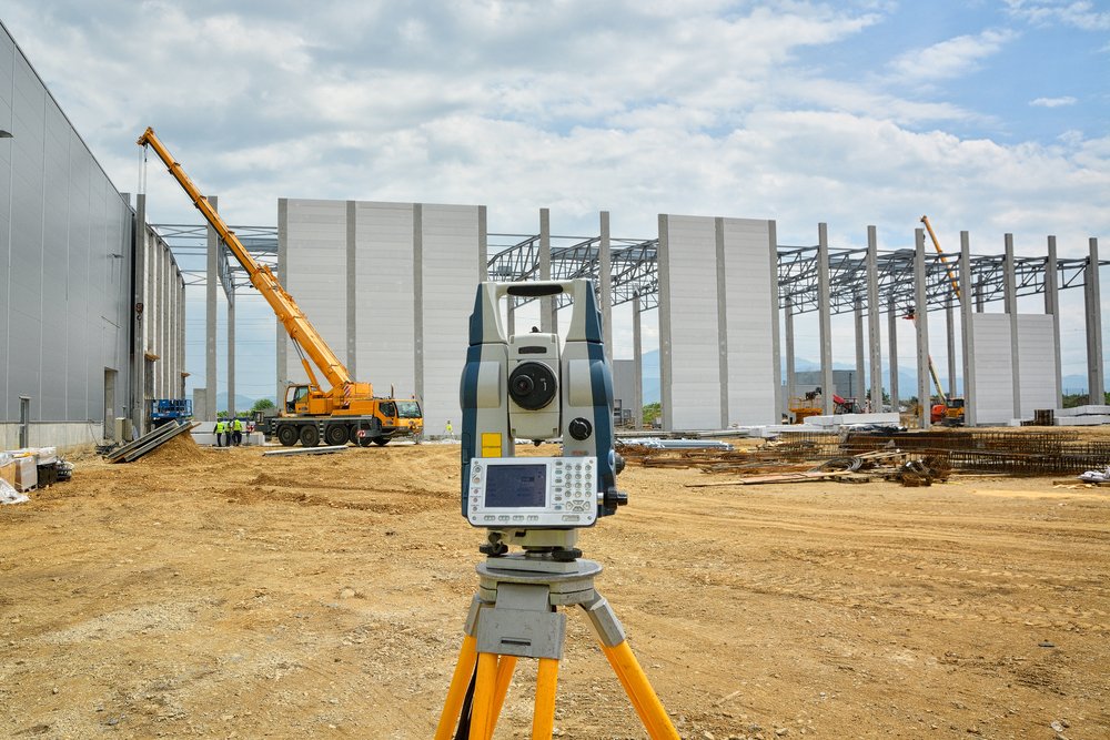
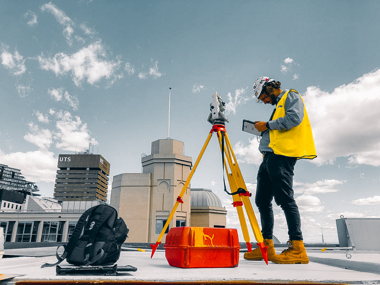
Engineering Surveys

Engineers and architects use surveying data to help them with planning, design and construction of their buildings. It can include topographic surveys, 3D laser scanning surveys and more.

During the design, planning, and pre-construction phases of a project, surveyors are responsible for taking precise measurements, updating boundary lines, and preparing space or land for construction. They also provide important information to project managers and owners that will help them determine whether a site is usable for the intended purpose.

In the United States, the American Society of Civil Engineers (ASCE) defines engineering surveying as activities involved in the planning and execution of surveys for the planning, design, construction, operation, and maintenance of engineered projects. ASCE believes that the provision included in NCEES Model Law that “surveying incidental to the practice of engineering” is equivalent to this definition of surveying.

Aerial Surveys

Aerial surveys are an increasingly popular form of surveying that allows surveyors to cover a large area and get high-resolution images. The photos can be used to create a range of products, including topographical maps, aerial photographs and more.

A surveyor will first identify the area of interest and set up a temporary site where they can take the aerial photos. They will also need to be careful not to interfere with any buildings or people on the property during the survey.

Aerial surveys are a fast and efficient way to capture high-quality imagery. They can be completed in one single flight and are ideal for larger sites or areas that are hard to reach.

If you’re planning to undertake a construction project, it’s important to hire surveyors in Wollongong before you start. They can help you avoid costly pitfalls and get the job done right.

Land surveyors are experts in determining the boundary lines and above-ground utilities on a property. This helps ensure that you don’t build anything outside of your property boundaries.

Road Design

Road design is a crucial aspect of any construction project, and it requires the skills of a Wollongong surveyor. They are responsible for ensuring that the roadway is constructed in a manner that meets all legal requirements and safety standards, while also optimizing the costs of the construction project.

A good road design includes elements such as the number and width of lanes, alignment, cross slopes, designed cross sections, excavation and embankment volumes, drainage structures, turnouts, and surfacing requirements. The design also considers the equipment anticipated for use during construction and how this will affect material movement distances and balance points.

Road geometry also impacts the sight distance available to a vehicle driver, and the road engineer works to ensure that the line of sight is clear before a hill crest or object blocks it. This is important for the safety of motorists and other road users.

Boundary Lines

When you are building a new home, it is essential to have the property boundaries surveyed before you start work. This will help you prevent encroachment on your neighbor’s land.

Similarly, for construction projects that are in strict city zoning, it is important to have a survey conducted to ensure that all land boundaries are clearly defined before the project begins. A quality Wollongong surveyor will be able to carry out these services for your benefit, saving you time and money.

Many neighbors resolve their boundary questions by simply agreeing on a line that makes sense to both of them. When this agreement is made and certain conditions are met, it becomes the permanent legal boundary between the two properties. It is binding not only on those neighbors, but on later buyers as well.

Visible Utilities

If you’re planning a construction project in Wollongong, hiring a reliable team of surveyors can help ensure your construction project runs smoothly. They can also save you time and money by preventing any unnecessary expenses.

Quality Level C, the most commonly used quality level, is based on surveying visible above-ground utility facilities and correlating them to existing utility records (QL-D information). This method is often the most effective for rural projects because most underground utilities are either omitted or incorrectly plotted.

Quality Level A, which GPRS provides with every utility locating job, involves physically locating the actual utility – often by “potholing” it or daylighting it – and subsequently locating it horizontally and vertically by survey measurements. This data can be utilized on any job and is especially helpful for verifying concrete encased duct banks.

Easements

An easement is a right of access held by someone else to use a certain piece of land. It is used to run services like power, water and telecommunications or put in roads.

A common example of an easement is a drainage easement, where drainage pipes will pass through multiple properties to enable water and sewerage to be drained. This helps to benefit the whole neighbourhood and can be useful for building development.

Another type of easement is an Easement of Way, also known as a carriageway, whereby one owner grants access to another for a defined strip of land. This can appear as an encumbrance to the property owner that the easement passes through but is a benefit to the person who owns the plot to which it provides access.

A surveyor can help you identify easements on your property. They can help you determine whether or not they are legal and how they will impact your construction project.

Surveyors in Canberra use a variety of techniques to determine the true shape of land. They provide data for civil engineers who plan infrastructure, including roads, bridges and buildings.

These professionals are essential for projects that require a planning permit. They also help with zoning and overlays, such as those that protect vegetation, heritage or wildlife.

The National Capital Authority (NCA)

The National Capital Authority (NCA) performs a range of functions in respect of protecting the Commonwealth’s interest in planning and managing Canberra as Australia’s capital.

It prepares and administers a National Capital Plan that serves the interests of the Australian Government, the nation and its people. It shapes the future of the capital; manages and enhances the nationally significant parts of Canberra; and fosters awareness of Canberra as Australia’s national capital.

For the first 75 years of Canberra’s development, the design plan was based on the vision of the Americans Walter Burley Griffin and Marion Mahony Griffin that placed it as a ‘city in the landscape’ nestled amongst forested hills and astride the impounded waterway of the Molonglo River. The two land and water axes were aligned with four local mountain summits and crossed the city to link nationally significant building sites in conspicuous positions against the forested landscape as a backdrop.

Since self-government in 1988, planning has been governed increasingly by the global orthodox canon of increasing urban densification and high-rise buildings without regard for the significance of the context and setting of Canberra. The result is low priority of heritage considerations leading to loss of heritage precincts and downplaying of the historic landscape ethos that encapsulates Canberra’s unique character and symbolic meaning.

Traversing

Canberra is known for its expansive parklands, lakes and urban forests. Treed spaces are a key feature of the city’s design and provide many benefits including cooling, shade and landscape amenity.

But the trees’ unique character is threatened by the accelerating pace of urban development and climatic change. As a result, the canopy cover in Canberra’s older suburbs is declining and new suburban areas are growing without extensive tree coverage.

In this paper, we explore the role of traversing in shaping Canberra’s urban landscape and how it can contribute to re-wilding and climate responsive urban planning and governance practices for cities as coupled human-natural systems.

In this study, we conducted interviews with experts from a range of disciplines that work with or have an interest in green spaces in Canberra. These experts reflected on the value of Canberra’s green spaces and discussed the Ecosystem Services (ESS) they provide.

Offsetting

Architects, engineers and planners depend on surveying data to design and construct buildings. They use topographic and 3D laser scanning surveys to understand the land.

They also use Geographic Information Systems (GIS) to present spatial information visually as maps, reports and charts. They overlay aerial and satellite images with GIS data to plan roads, utilities, and landscaping projects.

When planning a large infrastructure project, they need to be aware of the environment and how it affects construction. These measurements help them make informed decisions and ensure that the construction process goes smoothly.

Offsetting is a form of accounting that nullifies financial entries with equal but opposite entries to cancel out the original entry. It is a key principle of accounting and a powerful tool to limit or eliminate liabilities.

Surveyors

Surveyors use the latest technology to take measurements of land, and provide data that architects, engineers and planners need for planning and building. The data is then used to plan roads, bridges and utilities.

Surveyors make precise measurements to determine property boundaries, which can help prevent and resolve disputes. They also use their measuring equipment to create maps and reports that show changes in property lines.

They work outdoors and often cover long distances when conducting their surveys. This can be physically demanding, so employers often look for candidates with excellent physical stamina and problem-solving skills.

The job is generally full-time with a government or private organisation. During the course of a project, surveyors may travel across different parts of the country and stay away from home for an extended period.

Whether you’re building a home or a commercial property, having a land survey performed can be very helpful. But there are several different types of surveys, and which one you need depends on the purpose.

A boundary survey is used to identify and mark property boundaries on a parcel of land. It involves both record and field research, as well as measurements.

Boundary Survey

Boundary surveys are an essential step for property owners, whether they’re buying or selling. They help define boundaries legally so no one gets confused about what they own.

A boundary survey involves a combination of research and field work. The former involves reviewing historic documents like deeds, title certificates, part surveys, and easements while the latter involves taking physical measurements of a site.

The results of this type of land survey are shown on a plat, which is a scale drawing that shows the bearings and distances of the property lines as well as the total acreage. It also includes the location of man-made improvements such as fences, driveways, and buildings.

Topographic Survey

A Topographic Survey enables the precise measurement of land features and contour lines. It is most often used by engineers and architects for planning and designing buildings and other improvements on a site.

For example, if you want to build a house or commercial building on steep or unstable land you’ll need a topographic survey. It will show you if you need to move the location of the building, level out the ground, or add grading to the surface.

Other situations that may require a topographic survey include plans for preserving or altering local vegetation. In these cases you’ll need to meet permitting requirements and provide plans to replace the trees or other plant life that will be damaged during construction.

Location Survey

There are many different reasons to have a land survey done on your property. From establishing boundaries to helping you adhere to local laws, it can be a useful investment.

A Location Survey is the most basic type of land survey. It shows your property lines and illustrates the structures on your property.

It is usually used when you are looking to purchase a piece of property or if you need to meet zoning permit or loan application requirements. It is also important to get a location survey before building a fence or any other improvements on your property.

ALTA / ACSM Survey

An ALTA / ACSM Survey is the most comprehensive land title survey available. It depicts each element of a property that affects its ownership, including boundaries, site improvements, easements and rights-of-way.

This survey is required by most lenders, title companies, attorneys and buyers of commercial property. It complies with standards set by the American Land Title Association and the American Congress on Surveying and Mapping, now part of the National Society of Professional Surveyors (NSPS).

The research that an ALTA / ACSM Survey performs involves both public and private land records. It also includes a physical analysis of the property and boundary lines by the surveyors’ field crew.

Mortgage Survey

Mortgage surveys are an important part of the home purchase process. They provide valuable information that will satisfy the lender, determining whether the property will cover its loan.

The Mortgage Survey is used to determine the boundaries of your land and note any buildings, sheds, fences, easements and natural landmarks on it. This will help you steer clear of property line disputes with neighbors and ensure your structure meets current zoning regulations.

These surveys can also show where improvements can be made such as driveways and sidewalks. Like as-built surveys, they can be useful in planning your future improvements and additions on the property.

Subdivision Survey

When it comes to land surveying, one of the most important tasks is dividing a property into smaller lots (or tracts). It can be done for a number of different reasons, so it’s important to make sure that everything goes smoothly.

Typically, a subdivision survey is required when a parcel of land is divided into more than one lot, also called “lots.” This survey must be recorded by local and state government agencies. It’s also used to design streets and drainage systems, so it’s important to get it right the first time.

Surveying is a science with many technical and legal issues. This requires a professional land surveyor to be well-trained and licensed.

Throughout their career, surveyors are expected to adhere to ethical standards that protect clients and society at large. This course will review those standards of ethics, integrity and moral conduct that every surveyor should embrace, maintain and uphold in their practice.

1. Honesty

When it comes to land surveying, honesty is one of the most important qualities. It’s essential that a land surveyor is honest because it will help them avoid legal issues in the future.

This is particularly true when dealing with encroachments. This will save you time and money down the line.

Honesty is also important when it comes to property lines. It’s crucial that they are clearly plotted down in black and white so there will be no disputes between neighbors.

It’s also important that a land surveyor is honest because they will have the last say on how they interpret the data they gather. It’s their responsibility to ensure that they’re not overcharging for their services and that they’re doing the best job they can do.

2. Integrity

Integrity is one of the most important elements of a surveyor’s work. It’s essential to ensuring accuracy and making sure that your project is completed correctly.

Land surveyors are often required to conduct accurate surveys in extremely remote areas. This requires precision and access to a wide variety of tools.

A professional land surveyor should avoid even the appearance of professional impropriety and should act with fidelity to their clients, employers and peers.

In addition, they must be truthful in their public statements, avoiding the appearance of misleading ostentatious or laudatory implications.

This can include a statement of experience, facilities, personnel and capacity to render service; brochures and other factual representations; and preparation or authorization of descriptive articles for the lay or technical press that are not misleading with respect to their direct participation in projects described.

All land surveyors must know their state’s laws and guidelines related to ethics and professionalism in order to stay compliant with them. These laws are designed to protect the safety, health and welfare of the public and ensure that the profession remains honest and trustworthy.

3. Fairness

In land surveying, fairness is very important. It is your duty to ensure that you are fair to all parties involved in the project. If you come across a situation where you are not, then you should bring it to the attention of your client as soon as possible.

Fairness is also extremely important for your own reputation as a surveyor. If a client thinks that you are not fair, then you can potentially lose a lot of business.

Another very important aspect of fairness is that you should not overcharge for your services. There are a lot of dishonest surveyors out there that will take advantage of their clients.

You should always start a project with fairness in mind and make sure that you do not overcharge for the services that you provide. This will not only benefit you, but your clients as well. You will never want to hurt your reputation or your business by delivering subpar results to your clients.

4. Professionalism

Professionalism is a set of behaviors that show you’re committed to upholding certain rules and expectations within your field, workplace or role. These include getting dressed professionally, treating others with respect and observing company policies.

In the world of land surveying, professionalism is especially important because a survey must be accurate and complete quickly to meet time deadlines. If a lengthy survey delays a project, it can have disastrous consequences for the entire development process.

Licensed surveyors are expected to conduct themselves in accordance with the ethics and standards of their profession, as set by their state board or society. These standards are based on the principles of honesty, integrity and fairness.

The world of surveying has a long history. It has been around for thousands of years and it remains an important part of the world today.

The basic principles of land measurement are the same across the world. Measurements of the Earth’s surface are made with a variety of instruments and methods.

The Mason-Dixon Line

The Mason-Dixon Line was the result of numerous colonial and state boundary disputes. These included the disputes between the Calvert family in Maryland and William Penn of Pennsylvania.

They settled their disputes in 1732 with an agreement that specified specific borders for both territories. However, the lines still caused a lot of trouble between the two families.

After the surveyors were gone, the term “Mason-Dixon Line” became more commonly used to describe the boundary between states that allowed slavery and those that did not. This was especially true during the Civil War, when southern troops fought against northern troops.

The Mason-Dixon Line began to become a symbolic border between free and slave states, with the two British men who created it, Charles Mason and Jeremiah Dixon, becoming synonymous with this symbolism.

The Great Pyramid

Among the many great monuments of ancient Egypt, the Great Pyramid of Giza stands out as one of the most famous. The construction of the pyramid required an incredible amount of labor and resources.

This labor was done by a large number of skilled and unskilled workers. The annual inundation of the Nile River provided much-needed farmland that the kings could use to build their pyramids and other monuments.

Most of the pyramid stones in the Great Pyramid were transported from a quarry in Aswan, about 1000 km from Cairo. These were cut and fitted together with high precision.

The Great Wall of China

Stretching thousands of miles and featuring countless lookout towers, the Great Wall was an important military fortification to defend China against northern invaders. It has since become a symbol of Chinese history and culture, and is regarded as one of the world’s top tourist sights.

During the Qin Dynasty (221-207 BCE), Emperor Qin Shi Huang ordered that a strong wall be built to help keep out northern invaders like the Mongols. The wall was constructed of stone and earth and included watchtowers, beacon towers to send smoke signals and blockhouses to house soldiers.

After the Qin Dynasty, many different dynasties continued to work on the wall. It was reconstructed during the Ming Dynasty and eventually became the largest military structure in the world.

The Lewis and Clark Expedition

The Lewis and Clark Expedition (1804-1806) is a famous land surveying project that changed the course of American history. Meriwether Lewis and William Clark led the Corps of Discovery on an exploratory journey that ultimately reached the Pacific Ocean.

During the journey, they came across friendly Mandan and Minitari Indians who helped them build Fort Mandan along the Missouri River near present-day Washburn, North Dakota. The explorers were then able to obtain information from the Indians and French-Canadian traders who lived nearby.

While the explorers made their way up the Missouri River, they stopped at a spring where they observed “immense herds of Buffaloe, Elk, deer & Antelopes feeding in one common and boundless pasture.” The river became more difficult to navigate.

George Washington Smyth

Land surveyors have played an important role in our history. In fact, several famous historical figures were land surveyors.

George Washington, the first president of the United States, began his surveying career in 1749 at the age of 17. In a career that lasted over 50 years, he surveyed over 200 plots of land and played a vital role in western expansion.

During the colonial era, European powers needed detailed maps to back up their land claims in the new world. This led to the development of more advanced surveying techniques.