Understanding Elevation Data and How It Can Be Used in GIS

[ad_1]

Understanding Elevation Data and How It Can Be Used in GIS

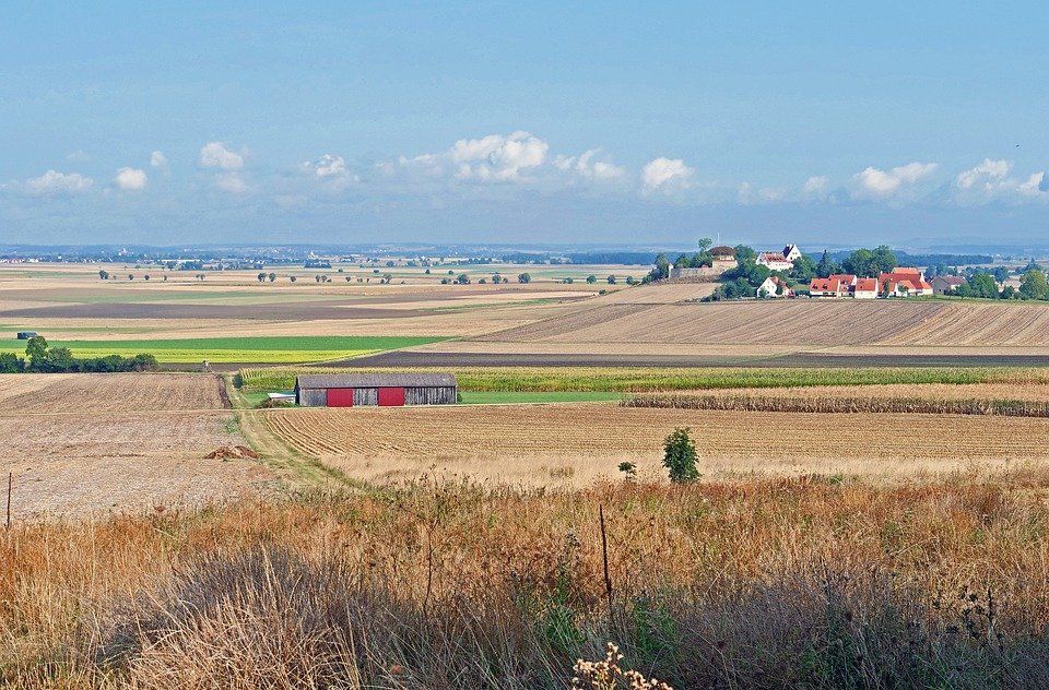
Elevation data is a type of geographic information system (GIS) data that measures the height of a location above sea level. This data is useful for many different applications, from land use planning to environmental research. It can also be used to produce detailed maps of terrain features such as mountains, valleys, and rivers. In this article we will explore how elevation data can be used in GIS, and the different ways it can be collected and analyzed.

Data Collection

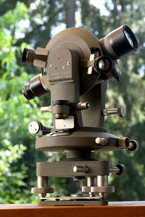
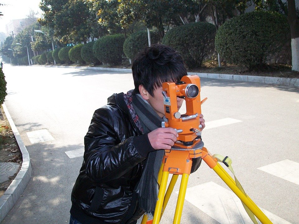
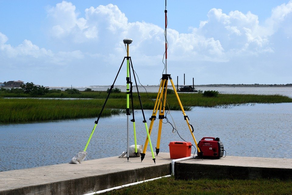
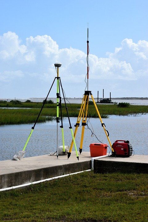
There are several methods for collecting elevation data, such as aerial photography, satellite imagery, and ground surveys. Aerial photography provides highly detailed images of the landscape, which can be used to measure elevation changes. Satellite imagery provides less detail but is useful for providing a large-scale overview of an area. Ground surveys involve taking measurements from the ground with the use of specialized equipment such as total stations and GPS receivers.

Data Analysis

Once the data has been collected it can then be used for a variety of analysis tasks. One of the most common uses of elevation data is to create digital elevation models (DEMs). DEMs are three-dimensional representations of the terrain that can be used to measure slope, aspect, and other terrain features. DEMs can also be used to create contour maps, which show the changes in elevation over a given area.

Other types of analysis that can be done with elevation data include watershed analysis, which is used to identify the areas that contribute the most water to a particular river or stream. This data can be used to help manage water supplies and protect watersheds. Elevation data can also be used to identify areas that are prone to flooding and other natural disasters, as well as to plan for land use and development.

Uses of Elevation Data in GIS

Elevation data is used in many different GIS applications. For example, it can be used to create 3D fly-throughs of an area that show the terrain in a realistic and immersive way. Elevation data can also be used for route planning, as it can help to identify the most efficient route between two points. It can also be used to create accurate representations of the land surface for planning and land use purposes.

Conclusion

Elevation data is an important type of GIS data that can be used in a variety of applications. It can be collected using aerial photography, satellite imagery, and ground surveys, and it can be used to create digital elevation models, contour maps, and to conduct watershed analysis. It is also used for route planning, creating 3D fly-throughs, and for land use and development planning. Understanding elevation data and how it can be used in GIS is essential for anyone who works with geographic information systems.
[ad_2]

How Control Points Can Help You Achieve Optimal Process Efficiency

[ad_1]

How Control Points Can Help You Achieve Optimal Process Efficiency

Control points are critical components of any process management system. They are used to measure and monitor the performance of a process, to identify areas of improvement and to ensure that the process is running smoothly. Control points are also used to identify and manage risks associated with the process, and to ensure that the process is meeting its goals. By using control points, businesses can maximize their process efficiency and ensure optimal results.

What are Control Points?

Control points are predetermined milestones in a process that provide a clear indication of progress. Control points are typically used to measure the performance of a process in terms of time, cost, quality, and other factors. Control points are often used to identify areas of improvement and to ensure that the process is meeting its goals.

Benefits of Using Control Points

Using control points allows businesses to maximize their process efficiency and reduce costs associated with inefficient processes. Control points provide businesses with real-time visibility of their processes, allowing them to quickly identify areas of improvement and take corrective action. Additionally, control points enable businesses to identify risks associated with their processes and take proactive steps to mitigate them.

How to Set Up Control Points

Setting up control points requires businesses to first identify the key objectives of their process and the key performance indicators that will be used to measure its success. Once these objectives and KPIs are established, businesses can then identify the specific control points they want to measure. Control points should be set up in such a way that they provide a clear indication of progress and enable businesses to quickly identify any areas of improvement or risks associated with their processes.

Best Practices for Implementing Control Points

Once control points have been established, businesses should ensure that they are being monitored regularly. Regular monitoring of control points will allow businesses to quickly identify any issues or risks associated with their processes and take corrective action. Additionally, businesses should ensure that the control points are measurable and that data from them is accurate and reliable. Finally, businesses should ensure that they are using the right tools to monitor their control points and that they are regularly checking in to ensure that their processes are running efficiently.

Conclusion

Control points are critical components of any process management system and can help businesses maximize their process efficiency and reduce costs associated with inefficient processes. By setting up control points, businesses can quickly identify areas of improvement and take corrective action. Additionally, businesses should ensure that their control points are monitored regularly and that they are using the right tools to monitor their control points. By following these best practices, businesses can ensure that their processes are running smoothly and that they are achieving optimal process efficiency.
[ad_2]

What is Geodetic Technology and How Can It Help Surveyors?

[ad_1]

What is Geodetic Technology and How Can It Help Surveyors?

Geodetic technology is the science of measuring, mapping, and understanding the size, shape, and relative positions of large geographic areas. It is commonly used in surveying, navigation, and geographic information systems (GIS). Geodetic technology is a critical tool for many surveyors and mapping professionals.

What is Geodetic Technology?

Geodetic technology is the science of measuring, mapping, and understanding the size, shape, and relative positions of large geographic areas. It is commonly used in surveying, navigation, and geographic information systems (GIS). Geodetic technologies include the use of global positioning systems (GPS), satellite navigation systems, and aerial photography.

Geodetic technology is based on the principles of geometry and trigonometry. It is used to measure, map, and manipulate the Earth’s surface. It is also used to determine the distance between two points, the direction between two points, and the angle between two lines.

How Can Geodetic Technology Help Surveyors?

Geodetic technology can be used by surveyors to accurately measure, map, and manipulate large geographic areas. Geodetic technology can be used to measure distances, angles, and elevations. It can also be used to create precise maps and drawings of geographic areas.

GPS technology can be used by surveyors to measure distances and angles with great precision. GPS is also used to create precise maps of geographic areas. Satellite images can be used to create detailed three-dimensional maps of geographic areas. Aerial photography is also used to create detailed maps of geographic areas.

Geodetic technology can also be used to create digital terrain models (DTMs). DTMs are used to represent the shape and elevation of the Earth’s surface. They can be used to determine the location of features such as buildings, roads, rivers, and lakes.

Conclusion

Geodetic technology is a critical tool for many surveyors and mapping professionals. It can be used to accurately measure, map, and manipulate large geographic areas. GPS technology can be used to measure distances and angles with great precision. Satellite images can be used to create detailed three-dimensional maps of geographic areas. DTMs can be used to determine the location of features such as buildings, roads, rivers, and lakes. Geodetic technology is an invaluable tool for surveyors and mapping professionals.
[ad_2]

Understanding Topographic Surveys: What a Land Surveyor Needs to Know

[ad_1]

Understanding Topographic Surveys: What a Land Surveyor Needs to Know

Topographic surveys are an integral part of land surveying and it is essential for land surveyors to understand what topographic surveys involve, and how to accurately and effectively use them to provide accurate measurements and data. Topographic surveys are used to map out the land, including its elevation, contours, and features, and are commonly used for construction, engineering, and environmental planning.

What is a Topographic Survey?

A topographic survey is a survey that measures the physical features of a piece of land, such as its elevation, contours, and features. It is a detailed survey that is used to accurately map out the land and its features in order to provide measurements and data for construction, engineering, and environmental planning. It is important to note that a topographic survey is different from a boundary survey, which is used to determine the boundaries of a piece of land.

Types of Topographic Surveys

There are several different types of topographic surveys available, depending on the specific needs of the project. The most common type of topographic survey is a planimetric survey, which measures the horizontal features of the land, such as the elevation, contours, and features. Another type of topographic survey is a topographic-photogrammetric survey, which uses aerial photography to measure the land from a bird’s eye view. Finally, a hydrographic survey measures the depth and contours of bodies of water, such as rivers and lakes.

Tools Used in Topographic Surveys

The tools used in topographic surveys vary depending on the type of survey being performed. For example, a planimetric survey will typically use a total station, which is a surveying instrument that uses laser technology to measure the distance and elevation of the land. For a topographic-photogrammetric survey, aerial photography is used to measure the land from a bird’s eye view. Finally, a hydrographic survey will typically use sonar technology to measure the depth of water.

Process of a Topographic Survey

The process of a topographic survey typically begins with the land surveyor establishing survey control points, which are used as reference points for the survey. The surveyor then collects data by taking measurements of the land using the appropriate surveying tools. Once the data is collected, it is then compiled into a map or report that is used to accurately measure the land and provide measurements and data for construction, engineering, and environmental planning.

Benefits of a Topographic Survey

Topographic surveys are an essential tool for land surveyors and can provide many benefits. A topographic survey can provide accurate measurements and data, which can be used to plan out construction projects, engineering projects, and environmental planning projects. Additionally, topographic surveys can be used to identify hazards and risks on the land, such as hazardous terrain or unstable structures.

Conclusion

Topographic surveys are an important tool for land surveyors, and it is essential for land surveyors to understand what topographic surveys involve and how to accurately and effectively use them. Topographic surveys provide accurate measurements and data, which can be used for construction, engineering, and environmental planning projects. Additionally, topographic surveys can be used to identify hazards and risks on the land.
[ad_2]

A Comprehensive Guide to Understanding the Basics of Subdivision Surveying

[ad_1]

A Comprehensive Guide to Understanding the Basics of Subdivision Surveying

Subdivision surveying is a specialized type of surveying and mapping that is used to divide a tract of land into individual lots and parcels. It is a complex process that requires a thorough understanding of land boundaries, legal requirements, and the local area. This guide will provide an overview of the basics of subdivision surveying and the various steps involved in creating a subdivision plan.

The Role of the Subdivision Surveyor

The subdivision surveyor is responsible for the overall project, from initial assessment to the final survey. They must be familiar with the applicable laws and regulations in order to create an accurate and legally compliant subdivision plan. The surveyor must also have an in-depth knowledge of the local area, including topography, boundaries, and any other relevant information. Once the surveyor has completed their assessment, they will create a subdivision plan that divides the tract of land into individual lots and parcels.

Types of Subdivision Surveying

There are two main types of subdivision surveying: horizontal and vertical. Horizontal subdivision surveying is used to create a plan that lays out the boundaries of the individual lots and parcels in the subdivision. Vertical subdivision surveying is used to determine the elevations of the lots and parcels, as well as any other relevant information.

Steps in Subdivision Surveying

The process of subdivision surveying typically involves several steps, each of which must be completed in order to create a successful subdivision plan. The steps in subdivision surveying include:

• Initial Assessment: The surveyor will assess the area and collect any relevant information. This includes topography, boundary lines, and any other relevant data.

• Field Survey: The surveyor will then conduct a field survey to collect data on the area. This includes establishing boundary lines, taking measurements, and collecting any relevant information.

• Final Survey: The surveyor will then use the data collected during the field survey to create the final survey. This includes creating the subdivision plan and any other relevant documents.

Subdivision Plan

Once the surveyor has collected all of the relevant data and created the final survey, they will create a subdivision plan. This plan will lay out the boundaries of the individual lots and parcels in the subdivision. It should also include any other relevant information, such as the location of any easements or rights-of-way.

Conclusion

Subdivision surveying is a complex and detailed process that requires a thorough understanding of land boundaries, legal requirements, and the local area. This guide has provided an overview of the basics of subdivision surveying and the various steps involved in creating a subdivision plan. It is important for anyone looking to create a subdivision plan to understand the role of the surveyor, the types of subdivision surveying, and the steps involved in the process. With this knowledge, it is possible to create a successful subdivision plan.
[ad_2]

What Is a Boundary Survey and What Does It Tell You?

[ad_1]

What Is a Boundary Survey and What Does It Tell You?

A boundary survey is a survey of a property’s boundaries to determine exactly where the boundary lines are located. A boundary survey is typically conducted by a licensed land surveyor and is used to help property owners, buyers and sellers accurately determine boundaries, resolve boundary disputes and establish the legal rights of the property owners. The survey report will provide an accurate description of the boundaries of the property, which can be used for legal proceedings, such as filing a boundary dispute claim in court.

What Is Included in a Boundary Survey?

A boundary survey will include a detailed map of the property, as well as all relevant information about the boundaries of the property, such as measurements, descriptions of the location of the boundaries and notes about any existing structures on the land. The surveyor will also note any encroachments, such as fences, walls and other structures, that may be located on the property. Additionally, the surveyor may note any easements, rights of way and other restrictions that may affect the property.

Why Is a Boundary Survey Necessary?

A boundary survey is an important part of any property transaction. By providing an accurate description of the property and its boundaries, the survey can help to avoid disputes or legal issues that may arise. Additionally, it can provide peace of mind by helping to ensure that the property is accurately described and that the boundaries are legally established.

How Is a Boundary Survey Conducted?

A boundary survey is typically conducted by a licensed land surveyor who will use a variety of methods to accurately determine the boundaries of the property. This may include using aerial photographs, maps, Global Positioning Systems (GPS) and other methods to measure and map the boundaries of the property. The surveyor may also use traditional surveying techniques, such as measuring distances and angles, to determine the boundaries.

What Is Included in a Boundary Survey Report?

Once the boundary survey is completed, the surveyor will provide a detailed report of the findings. This report will include a detailed map of the property and a legal description of the boundaries. It will also include any notes about existing structures or encroachments on the land, as well as any easements, rights of way and other restrictions that may affect the property.

What Are the Benefits of a Boundary Survey?

A boundary survey can provide a number of benefits to those involved in a property transaction. It can help to avoid costly boundary disputes, provide an accurate description of the property, and provide peace of mind by helping to ensure that the boundaries are legally established. Additionally, it can provide valuable information about the property that can be used in legal proceedings, such as filing a boundary dispute claim in court.

Conclusion

A boundary survey is an important part of any property transaction and can provide valuable information about the boundaries of the property. It can help to avoid costly boundary disputes, provide an accurate description of the property, and provide peace of mind by helping to ensure that the boundaries are legally established. Additionally, it can provide valuable information about the property that can be used in legal proceedings, such as filing a boundary dispute claim in court.
[ad_2]

Understanding Boundary: The Basics of Property Lines

[ad_1]

Understanding Boundary: The Basics of Property Lines

Property lines are the boundaries that separate one piece of property from another. They are established by deeds, court rulings, or other legal documents, and are typically marked with physical features such as fences, walls, or other physical features. Understanding boundary is an important part of property ownership, as it helps to ensure that all adjacent property owners respect each others’ rights and boundaries.

What are Property Lines?

Property lines are the boundaries that separate one piece of property from another. They are typically established by deeds, court rulings, or other legal documents and are usually marked with physical features, such as fences, walls, or other physical features. Property lines are important because they help to determine who owns what and prevent disputes between property owners.

Why are Property Lines Important?

Property lines are important for a variety of reasons. For one, they help to ensure that all adjacent property owners respect each others’ rights and boundaries. This is important for both parties involved, as it prevents one party from encroaching on another’s property and eliminates potential disputes. Additionally, property lines help to protect a person’s right to privacy and ensure that they have exclusive use of their land.

How are Property Lines Established?

Property lines are typically established through a legal document such as a deed or court ruling. In some cases, a surveyor may be hired to determine the exact boundaries of a property. The surveyor will use various tools, such as boundary markers and boundary lines, to identify the exact boundaries of the property. The surveyor will then prepare a report that will serve as the legal document establishing the boundaries of the property.

How Can I Find My Property Lines?

If you are unsure of the exact boundaries of your property, the best way to find out is to contact your local government office or the office of the county or state assessor. These offices will be able to provide you with a map or other documents that can help you determine the exact boundaries of your property. In addition, many states offer online mapping services that can provide you with a detailed map of your property.

How Can I Protect My Property Lines?

Once you have established the boundaries of your property, it is important to protect them. This can be done by installing fences, walls, or other physical features that will clearly mark the boundaries of your property. Additionally, you should also consider filing a deed that will clearly state the boundaries of your property and provide legal protection in case of a dispute.

Conclusion

Property lines are important for a variety of reasons, as they help to determine who owns what and prevent disputes between property owners. It is important to understand the basics of property lines, as well as how to establish them and protect them. By understanding the basics of property lines, you can ensure that all adjacent property owners respect each other’s rights and boundaries and protect your own right to privacy and exclusive use of your land.
[ad_2]

City Surveyors perform boundary, topographic and design level surveys to support public projects and right of way acquisition. Depending on the scope of work, may also provide construction staking services.

Adelaide is on the cusp of a multi-billion transformation by 2050 that will have a profound impact on the way we live, work and play. The city is on the cutting edge of innovation and a new generation of high tech enterprises are driving the future of our city.

Building the Future of Adelaide The Expertise of City Surveyors

Asset Management

Asset management is the systematic process of maintaining, upgrading, and operating physical assets cost-effectively. It’s a critical business strategy that unlocks efficiency and accountability.

Often overlooked, asset management can contribute to the growth of an organization and improve financial sustainability. It’s also a key part of managing risk and reducing the costs of maintaining or disposing of your company’s assets.

As an asset manager, you work with a wide variety of property types and investment opportunities. Some managers specialize in specific regions or markets, and others are experts at the fundamentals of real estate analysis.

As an asset manager, you may be involved with property acquisitions, drafting property agreements and leases, and marketing commercial properties. The primary goals of asset management are to maximize revenue and minimize expenses in order to maintain stable net operating income.

Building Surveying

As a Building Surveyor, you assess and advise on the design, construction and maintenance of buildings. Ensure they meet legislative requirements for safety, sustainability and preservation.

You work with clients, construction crews and local planning authorities to ensure buildings are structurally sound, energy efficient, accessible, and able to be occupied safely. You conduct onsite inspections during the construction process and advise on building defects.

A good surveyor will carefully examine every element of a building, recording its dimensions and condition. This ensures they have a complete understanding of the building and its components before advising on any changes or repairs.

Planning

Planning is a process that requires defining goals, objectives and devising a strategy to achieve them. It also includes ensuring that resources are allocated for success.

Surveyors in Adelaide are experts in mapping and collecting data that can help to build a smart city. They are able to use data collection software such as building information modeling (BIM) to synchronize a digital database of existing infrastructure, improvements and future expansion plans.

Moreover, City Surveyors are skilled at identifying and pinpointing underground utilities and structures to reduce risk for property owners. They can provide a digital Utility Atlas, which provides a comprehensive map of all underground utilities and structures.

Planning can be a very complex process and requires participation from all relevant stakeholders. This ensures that everyone understands and is committed to achieving the plan.

Inspections

Inspections are a great way to ensure that the property you’re buying is safe, secure and in good condition. A professional home inspector will go through all of the major systems in a house and make note of any issues that could cause problems down the road.

A standard inspection includes checking the heating system, central air conditioning, plumbing, electrical system, roof, attic and visible insulation, walls, ceilings, floors, windows and doors. Some inspectors will also look for termite damage, mold and asbestos.

Surveying is a very complex process and requires a lot of expertise. A surveyor needs to invest in a variety of different instruments that will help them carry out the work properly. These include ranging rods, pegs and optical squares.

City surveyors are working with Brisbane city council to help plan the future layout of the city. This includes accommodating growth, building sustainable developments, improving transport, encouraging employment and keeping green spaces large and connected.

Australian capital cities are undergoing rapid urban expansion in response to the “Great Australian Dream” of home ownership. This expansion often occurs on the fringe of a city, where land is relatively cheap and financial returns are high.

The Importance of City Surveyors in Brisbanes Urban Development

1. Utility Atlases

When planning new developments or repairing existing ones, it’s important to locate and map underground utilities like electric wiring, gas lines, water pipes, sewerage networks and telecommunications. These maps help project managers avoid costly utility relocations and can reduce construction delays, damages and liability costs.

In Brisbane, Council identifies and invests in infrastructure as part of its Local Government Infrastructure Plan (LGIP). The LGIP shows where urban development is expected to occur and what type of services may be required for each zone.

In addition to LGIP, city councils can also use their long-term infrastructure plans and Netserv Plans. These provide Council with a better understanding of what needs to be delivered in the future. Among other things, these plans can include ratios for infill versus greenfield development.

2. Set-Out Surveys

Surveyors in Brisbane are working with Brisbane City Council to help plan the future layout of the city, accommodating growth, building sustainable developments, improving transport and encouraging employment.

The process of city planning also helps to ensure that green spaces are kept large and connected. This can increase social cohesion, reduce crime and encourage community participation.

Set-out surveys are an important part of the construction process and should be conducted before any construction work begins. Inaccurate set-outs can cause major problems later on, resulting in costly delays.

Set-out surveys are essential for many different construction projects, including residential and commercial development, roads, bridges, railways and more. They provide the base data for civil design and allow the construction team to build the project exactly as it was planned.

3. Surveying for Subsidence

City surveyors are in a unique position to help with the town planning of Brisbane. By designing places that are convenient to live, work and play, they can increase social cohesion, reduce crime and encourage community participation.

Creating smart cities requires accurate data. This means collecting the right information about existing infrastructure, improvements and future expansion plans.

Subsidence monitoring is one way that land surveyors can do this. They use specialised equipment to take precise measurements of the ground under a structure.

This can help them determine whether a property is susceptible to subsidence and how the issue might be remedied. They may also need to carry out geographical surveys that can identify issues with soil instability and drainage. This can also prevent subsidence from happening in the future.

4. Geotechnical Surveys

City surveyors are essential in Brisbane’s urban development as they provide key data and mapping for a range of projects. These include data collection and management, zoning and land use, and infrastructure.

For example, geotechnical surveys help to determine the soil conditions of a property. This information is important for any construction project.

Whether you’re planning to build a new house, renovate an existing property, or subdivide a block, you will need a plan and a permit. Your town planner will review your plans and check that they are in line with the current town planning codes.

5. Topographic Surveys

When it comes to developing residential and commercial space, topographic surveys are an essential part of the process. They help to design new buildings, new roads and drainage runs.

A topographical survey, also known as a feature contour survey, details the land’s features in terms of height, depth and size. These may include hills, rivers, trees and fences.

Using modern equipment such as drone survey photogrammetry, the data that a topographic survey captures can be used to create an accurate three-dimensional model of the site.

A topographic survey can provide the information that you need to obtain a zoning permit or mortgage loan for construction work on your property. It can also reveal any environmental issues that you need to know about before a project goes ahead.

Whether you’re planning a new house or a major renovation, navigating the Gold Coast’s complex property market requires accurate surveying. This is an essential step in protecting property owners’ rights, and avoiding costly disputes.

City surveying is the process of determining boundaries, locating sanitary and water pipes and identifying electrical lines. It involves using ranging rods, pegs, optical squares, and arrows.

What to Look for in a Professional City Surveyor in Gold Coast

Accurate Land Surveys

Accurate land surveys are an essential part of any property development project. They ensure that a property is built within its legal limits and prevent costly disputes down the line.

During an accurate land survey, a land surveyor uses an array of digital measuring equipment to map the location of points on the ground. These points include corner marks, a road frontage, an adjoining property and so on.

Once the measurements are collected, they are processed and compared to existing data. This can involve research and checks on past records (original surveys, recent subdivisions, or adjoining property surveys) to confirm that all of the original survey measurement data is correct and accurate.

This information is then digitally plotted on a digital map to provide the client with the most accurate evidence available to determine property boundaries. This process also involves converting old units of measurement (such as chains, rods, links and Spanish varas) into modern equivalents such as feet and US survey feet.

Boundary Realignment

Boundary realignment is an important consideration when it comes to navigating the Gold Coast’s complex property market. It is a process that can lead to a number of issues and requires expert surveying advice.

The first thing to note is that any adjustment to a suburban boundary needs to be approved by the Office of the Surveyor General and this can take up to six months or longer.

It is also a good idea to seek independent legal advice when attempting to resolve any such issues. Under Clause 2.75 of the Codes SEPP, a ‘boundary realignment’ must not increase the area of any lot by more than 10% in a residential zone.

This means that any change to a suburb boundary can be costly to undertake and may be problematic for some residents. As such, Council has undertaken preliminary consultation and will continue to seek community input on the issue. In the event that a majority of the ratepayers support the option to realign boundaries, Council will proceed with the proposal.

Topographic Surveys

Topographic surveys are a critical component of any property development project. They reveal all natural and man-made features on a site, including hills, rivers, trees, fences, buildings and other improvements.

While these surveys are often required by local government bodies, they can be used by engineers and architects for a myriad of practical applications. They also help to reduce the chance of terrain-related errors during construction.

A topographic survey map depicts the location, size and height of all land features and any gradual changes or contours in elevation. It also shows where roads, utilities and other infrastructure are located.

Historically, these maps were drawn manually and plotted on physical mediums such as paper. However, these days, they are often provided in digital form as a CAD drawing.

Cadastral Surveys

Cadastral surveys are a critical part of Land Surveyor in Gold Coast. They determine the physical location of property boundaries for legal purposes and before property taxes.

They also provide important information about how a piece of land is divided between different owners and parties. They can also be used to establish ownership of subsoil, water rights, and other features that are associated with a property.

The government entrusts licensed cadastral surveyors to maintain and protect the integrity of the cadastre. This helps people to have confidence in their lands and properties.

In addition, cadastral surveys help governments and land information agencies manage their cadastre data. This involves using GIS technology and cadastral survey software solutions.

The Gold Coast has experienced significant growth in property prices in the past year, driven by strong demand and tight supply. However, rising construction costs and tighter lending conditions could limit the region’s future growth. Despite these challenges, the region’s strong population growth and booming economy will likely continue to drive demand.