Cadastral Surveying: How It Impacts Property Ownership

[ad_1]

Cadastral Surveying: How It Impacts Property Ownership

Cadastral surveying is a branch of land surveying that deals with the delineation, mapping, and recording of land parcels and boundaries for property ownership. Cadastral surveys are used to establish and document property boundaries in relation to neighboring parcels and to create an official record of the land’s ownership. Cadastral surveys are used to establish ownership lines, identify rights and liabilities, and determine the size and shape of parcels of land. In this article, we will discuss how cadastral surveying impacts property ownership.

Establishing Boundaries

The most important role of cadastral surveying is to establish and define the boundaries of a property. The surveyor will use the legal description of the property, such as a deed, to create a “plat” or map of the land. This plat will show the exact boundaries of the property and the location of any improvements, such as buildings, trees, or fences. This map, along with the legal description, will be recorded and maintained in the public record.

Identifying Rights and Liabilities

Cadastral surveys also help identify the rights and liabilities of a property. The surveyor will identify any encroachments on the property, such as a fence that crosses the boundary line, as well as any easements, such as a utility line that runs through the property. The surveyor will also note any encumbrances on the property, such as a lien or mortgage, and any restrictions on the property, such as zoning regulations.

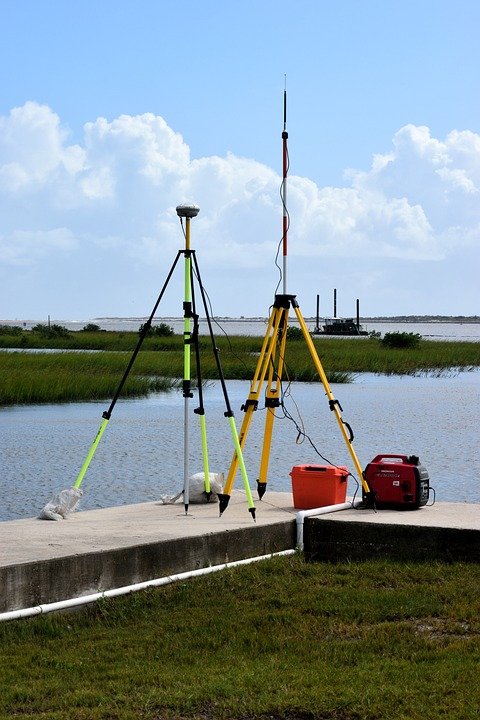
Determining Size and Shape of Parcels

Cadastral surveys also help to determine the size and shape of parcels of land. The surveyor will measure the boundaries of the property using specialized surveying equipment, such as a total station or GPS receiver. The measurements will be recorded and used to create a plat of the land that shows its exact size and shape. This plat can then be used to calculate the area of the land and to identify the exact boundaries of the parcel.

Conclusion

Cadastral surveying is an important part of property ownership. It helps to establish and document property boundaries, identify rights and liabilities, and determine the size and shape of parcels of land. By accurately recording these details, cadastral surveying helps to protect the rights and interests of all parties involved in a property transaction.
[ad_2]

An Overview of Cadastral Surveying: How It’s Carried Out and Its Benefits

[ad_1]

An Overview of Cadastral Surveying: How It’s Carried Out And Its Benefits

Cadastral surveying is one of the most important aspects of land surveying. It is the process of creating and maintaining detailed maps of land parcels and their boundaries. It is used to determine the ownership of land, its boundaries, and its value. The results of cadastral surveys are used in many different contexts, including legal disputes, real estate transactions, taxation, and land management.

What is Cadastral Surveying?

Cadastral surveying is the process of measuring and mapping out the boundaries of parcels of land and other features related to the parcels. It is usually done in a systematic way, with surveyors using specialized equipment to accurately measure and map out the boundaries of a parcel. The measurements are then used to create a cadastral map of the area.

The cadastral map will show the dimensions of each parcel, along with other features such as roads, waterways, and buildings. It can also show the ownership of the parcels, as well as any other information that may be relevant.

How is Cadastral Surveying Carried Out?

Cadastral surveying typically involves a few different steps. First, surveyors will establish a baseline for the survey, which is a set of points used to define the boundaries of the parcels. The survey then continues by measuring and mapping out the boundaries of the parcels.

Surveyors may use a variety of equipment to measure and map out the boundaries of the parcels, including total stations, electronic distance meters, and GPS receivers. Once the measurements are taken, they are used to create a cadastral map of the area.

Benefits of Cadastral Surveying

There are several benefits to using cadastral surveying. First, it is a very accurate way to map out the boundaries of parcels of land. It ensures that the boundaries are clear and that disputes between owners are minimized.

Second, cadastral surveying can be used to help determine the value of a parcel of land. By having an accurate and up-to-date cadastral map of a property, it is easier to determine its value.

Finally, cadastral surveying is a valuable tool for land management. By having an accurate map of the boundaries of parcels of land, it is easier to manage the land in a sustainable way.

Conclusion

Cadastral surveying is an important aspect of land surveying. It is used to accurately measure and map out the boundaries of parcels of land, and the results are used in many different contexts. Cadastral surveying offers many benefits, including accuracy, determining the value of properties, and aiding in sustainable land management.
[ad_2]