Utilizing Elevation Data to Accurately Represent Topography

[ad_1]

Utilizing Elevation Data to Accurately Represent Topography

Elevation data is a key component of understanding and accurately representing topography. Elevation data is used to create detailed topographical maps, analyze landforms, assess flood risk, and plan construction projects. This data is often gathered through the use of Global Positioning System (GPS) receivers and satellites. In order to create a detailed topographical map, elevation data must be collected from multiple sources and combined into a single, cohesive dataset.

GPS and Remote Sensing

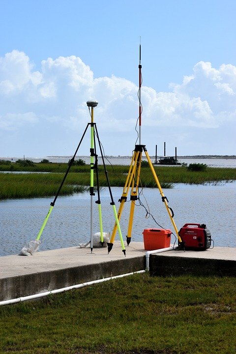
GPS receivers are used to collect elevation data from the ground. The receivers measure the distance between the receiver and a satellite. By measuring the distance from several satellites, the receiver can determine its exact position and altitude. Remote sensing is another method used to collect elevation data. This method uses sensors on satellites to measure the Earth’s surface. The data collected is used to create detailed topographical maps.

Creating Topographical Maps

Once elevation data has been collected, it can be used to create detailed topographic maps. These maps are used to understand the shape of landforms and to plan construction projects. Topographic maps are created by superimposing a two-dimensional grid over the elevation data. The grid is then broken up into squares and each square represents an elevation. By creating this grid, it is possible to accurately represent the shape of the land.

Analyzing Slope and Flood Risk

Elevation data is also used to analyze slope and to assess flood risk. By measuring the difference in elevation between two points, it is possible to calculate the slope of the land. This information is important when assessing the potential for landslides and other hazards. It is also used to determine potential flood zones. By analyzing the elevation data, it is possible to identify areas that are at risk of flooding and make informed decisions about where to build and how to protect against flooding.

Conclusion

Elevation data is an essential tool for accurately representing topography. By collecting data from multiple sources and combining it into a single dataset, it is possible to create detailed topographical maps. This data can also be used to analyze slope and assess flood risk. Elevation data is an invaluable tool for understanding the shape of landforms and for planning construction projects.
[ad_2]

Exploring the Potential of Elevation Data in Mapping Applications

[ad_1]

Exploring the Potential of Elevation Data in Mapping Applications

Elevation data is an important part of any map, and it can be used to provide valuable insights for a wide range of applications. From navigation to land management, elevation data can help us understand the terrain of a given area better, and can even provide insights into the environmental conditions of a given area. By exploring the potential of elevation data in mapping applications, we can gain a better understanding of the environment and how it affects our lives.

Elevation data can provide valuable information for a range of mapping applications. For example, it can be used to determine the most efficient route for navigation. By utilizing elevation data, a user can find the most direct route between two points, or can plan a route that takes into account the terrain of a given area. Additionally, elevation data can be used to aid in land management decisions. By obtaining information about the elevation of a given area, land managers can better understand the potential for development, or for environmental conservation efforts.

Elevation data can also be used to analyze the environmental conditions of a given area. By examining the elevation of a given area, we can gain valuable insights into the climate of the area, such as the temperature, precipitation, and wind patterns. This information can be used to assess the potential for agriculture, or to better understand the effects of climate change on a given region.

Gathering Elevation Data

The first step in exploring the potential of elevation data in mapping applications is to gather the necessary data. There are several methods of obtaining elevation data, including aerial photography, satellite imagery, and field surveying. Each of these methods has its own advantages and disadvantages, and should be carefully considered when deciding which method is best for a given project.

Aerial photography is one of the most common methods of obtaining elevation data. By taking aerial photographs of a given area, users can gain a detailed view of the terrain and can use this information to create an elevation map. However, it is important to note that aerial photography is only useful for areas that are within the range of the camera. Additionally, aerial photography can be expensive and may not be suitable for large-scale projects.

Satellite imagery is another method of obtaining elevation data. By using satellite imagery, users can get a detailed view of the terrain from a wide range of perspectives. Additionally, satellite imagery can be used to monitor changes in the terrain over time. However, satellite imagery can be costly and may not be suitable for smaller projects.

Field surveying is another option for gathering elevation data. By physically visiting a given area, users can take accurate measurements of the terrain and can create detailed elevation maps. Field surveying can be time-consuming, however, and may not be the best option for large-scale projects.

Using Elevation Data

Once the necessary elevation data has been gathered, it can be used in a variety of mapping applications. For example, elevation data can be used to create 3D maps of a given area. By utilizing elevation data, users can create detailed 3D models of a given area that can be used for navigation, land management, or environmental analysis. Additionally, elevation data can be used to assess the potential for development or conservation efforts in a given area.

Elevation data can also be used to analyze the environmental conditions of a given area. By examining the elevation of a given area, users can gain valuable insights into the climate of the region, such as the temperature, precipitation, and wind patterns. This information can be used to assess the potential for agriculture, or to better understand the effects of climate change on a given region.

Conclusion

Elevation data can be a valuable resource for a wide range of mapping applications. By exploring the potential of elevation data in mapping applications, we can gain a better understanding of the environment and how it affects our lives. From navigation to land management, elevation data can provide valuable insights into a given area, and can even be used to analyze the environmental conditions of a given area. By gathering the necessary elevation data and utilizing it in mapping applications, users can gain a better understanding of the environment and can make more informed decisions about how to best manage their resources.
[ad_2]

Understanding Elevation Data and How It Can Be Used in GIS

[ad_1]

Understanding Elevation Data and How It Can Be Used in GIS

Elevation data is a type of geographic information system (GIS) data that measures the height of a location above sea level. This data is useful for many different applications, from land use planning to environmental research. It can also be used to produce detailed maps of terrain features such as mountains, valleys, and rivers. In this article we will explore how elevation data can be used in GIS, and the different ways it can be collected and analyzed.

Data Collection

There are several methods for collecting elevation data, such as aerial photography, satellite imagery, and ground surveys. Aerial photography provides highly detailed images of the landscape, which can be used to measure elevation changes. Satellite imagery provides less detail but is useful for providing a large-scale overview of an area. Ground surveys involve taking measurements from the ground with the use of specialized equipment such as total stations and GPS receivers.

Data Analysis

Once the data has been collected it can then be used for a variety of analysis tasks. One of the most common uses of elevation data is to create digital elevation models (DEMs). DEMs are three-dimensional representations of the terrain that can be used to measure slope, aspect, and other terrain features. DEMs can also be used to create contour maps, which show the changes in elevation over a given area.

Other types of analysis that can be done with elevation data include watershed analysis, which is used to identify the areas that contribute the most water to a particular river or stream. This data can be used to help manage water supplies and protect watersheds. Elevation data can also be used to identify areas that are prone to flooding and other natural disasters, as well as to plan for land use and development.

Uses of Elevation Data in GIS

Elevation data is used in many different GIS applications. For example, it can be used to create 3D fly-throughs of an area that show the terrain in a realistic and immersive way. Elevation data can also be used for route planning, as it can help to identify the most efficient route between two points. It can also be used to create accurate representations of the land surface for planning and land use purposes.

Conclusion

Elevation data is an important type of GIS data that can be used in a variety of applications. It can be collected using aerial photography, satellite imagery, and ground surveys, and it can be used to create digital elevation models, contour maps, and to conduct watershed analysis. It is also used for route planning, creating 3D fly-throughs, and for land use and development planning. Understanding elevation data and how it can be used in GIS is essential for anyone who works with geographic information systems.
[ad_2]